Long-time London resident and avid museum and theatre-goer. I started this blog in 2014, and got serious about it in 2020 when I realised how much I missed arts and culture during lockdowns. I go to a lot more events than anyone would think is sensible, and love sharing my thoughts in the forms of reviews, the occasional thought piece, and travel recommendations when I leave my London HQ.
A visit to the Minervois region is a great opportunity to visit Olargues, one of France’s prettiest villages.
Mad Dogs and Englishmen
It’s definitely true what they say. Only mad dogs and Englishmen go out in the midday sun. Or walk to neighbouring French villages in the afternoon heat, as was the case here. No long-time readers will be surprised: the Salterton Arts Review is totally incapable of sitting still when in a new place. So on a recent trip to France, after a busy cultural weekend in Chantilly and venturing down to Occitanie to stay with family for a few days, a free afternoon became an opportunity to go exploring. From the lovely village of Mons, it was a short walk down to a walking/cycling path along a disused railway. And from there, just a slightly longer walk to Olargues. Not a bad idea, right?
In hindsight, a slightly bad idea. This region of France still has the right idea when it comes to living by the rhythms of nature. Restaurants and other businesses are seasonal, for a start. And opening hours are firmly divided by an afternoon siesta. It’s not that far from Spain, after all. So as you read this post and look at the lovely pictures, please bear in mind that the long-suffering Urban Geographer was cursing my name the whole time, and waiting in the shade while I went off to look at the next stop on my itinerary.
Thankfully oppressive heat is no match for my enthusiasm for history and culture, so I had a great time nonetheless. But if you have the opportunity to visit Olargues in the summer months, please learn from this cautionary tale and go in either the morning or the evening. Either way you’ll find Olargues a pleasant and interesting spot. But by visiting during the cooler parts of the day you’ll both sweat a little less, and have more spots to relax and enjoy the views.
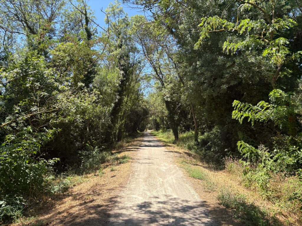
PassaPaïs: From Railway to Walking and Cycling Path
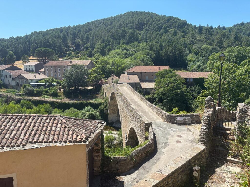
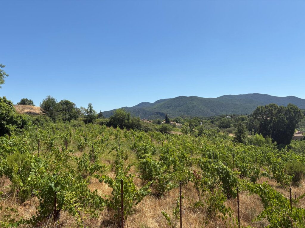
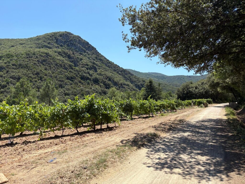
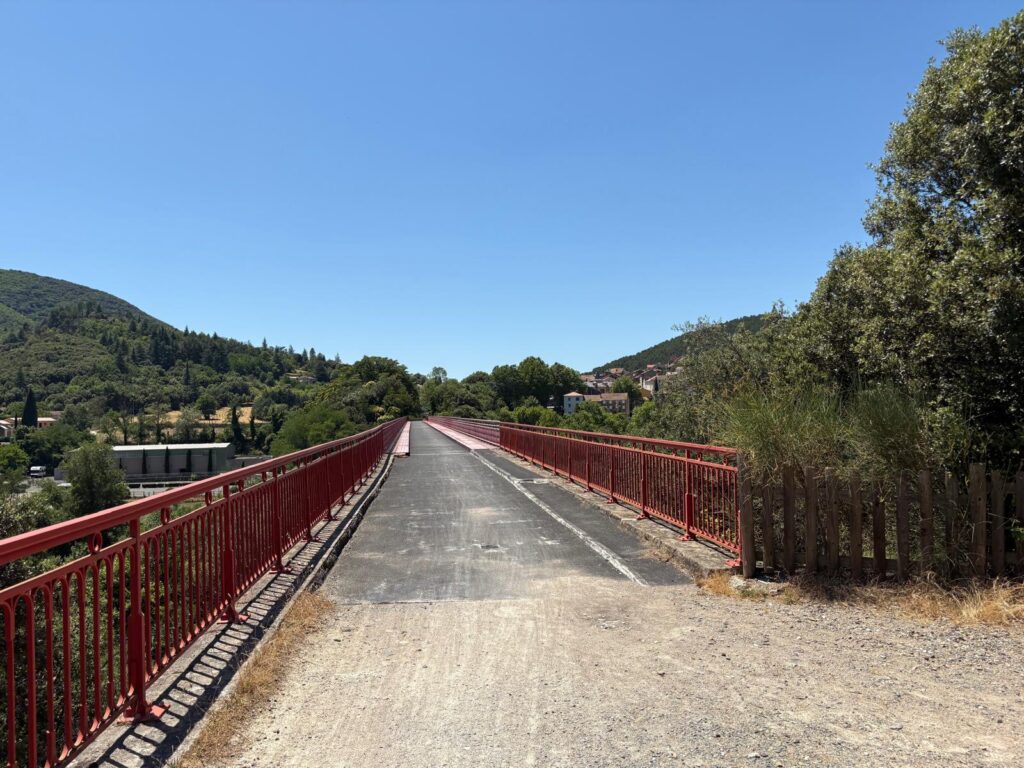
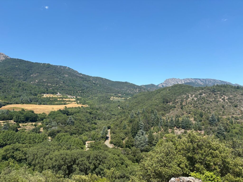
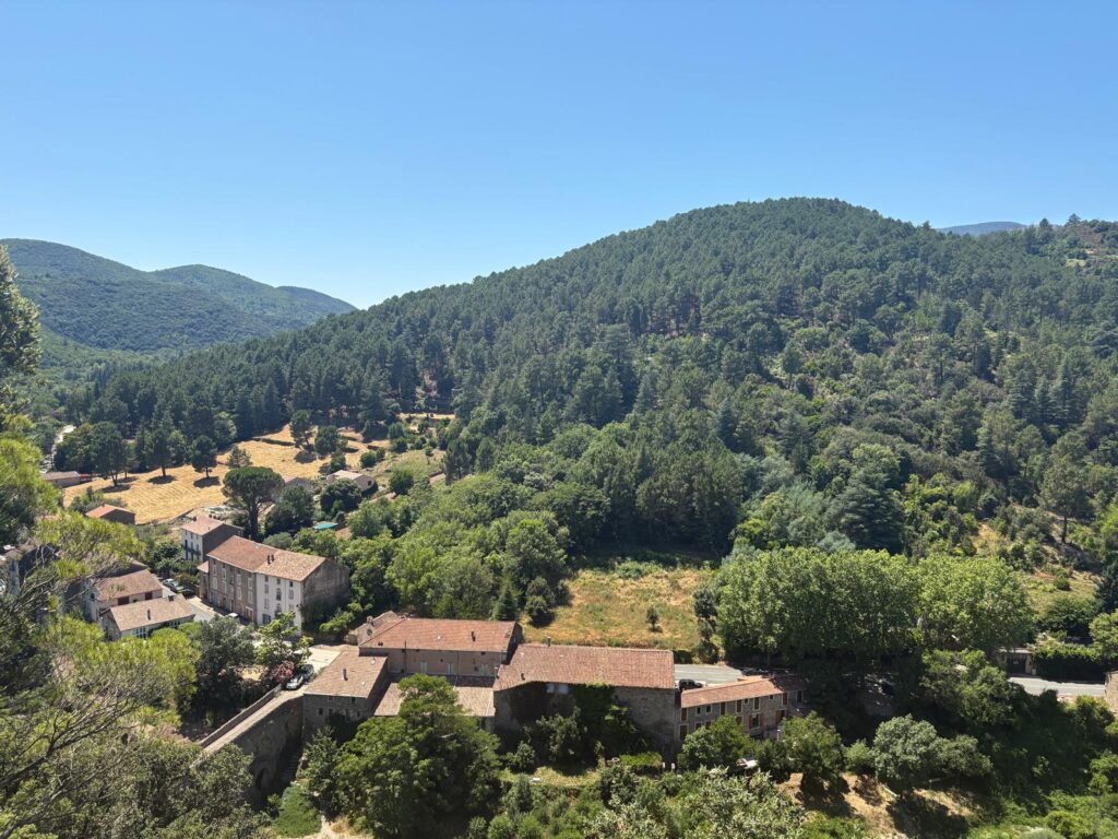
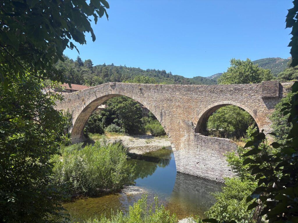
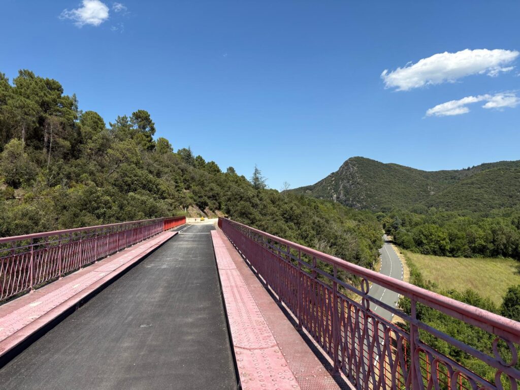
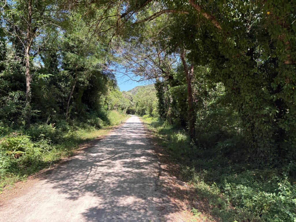
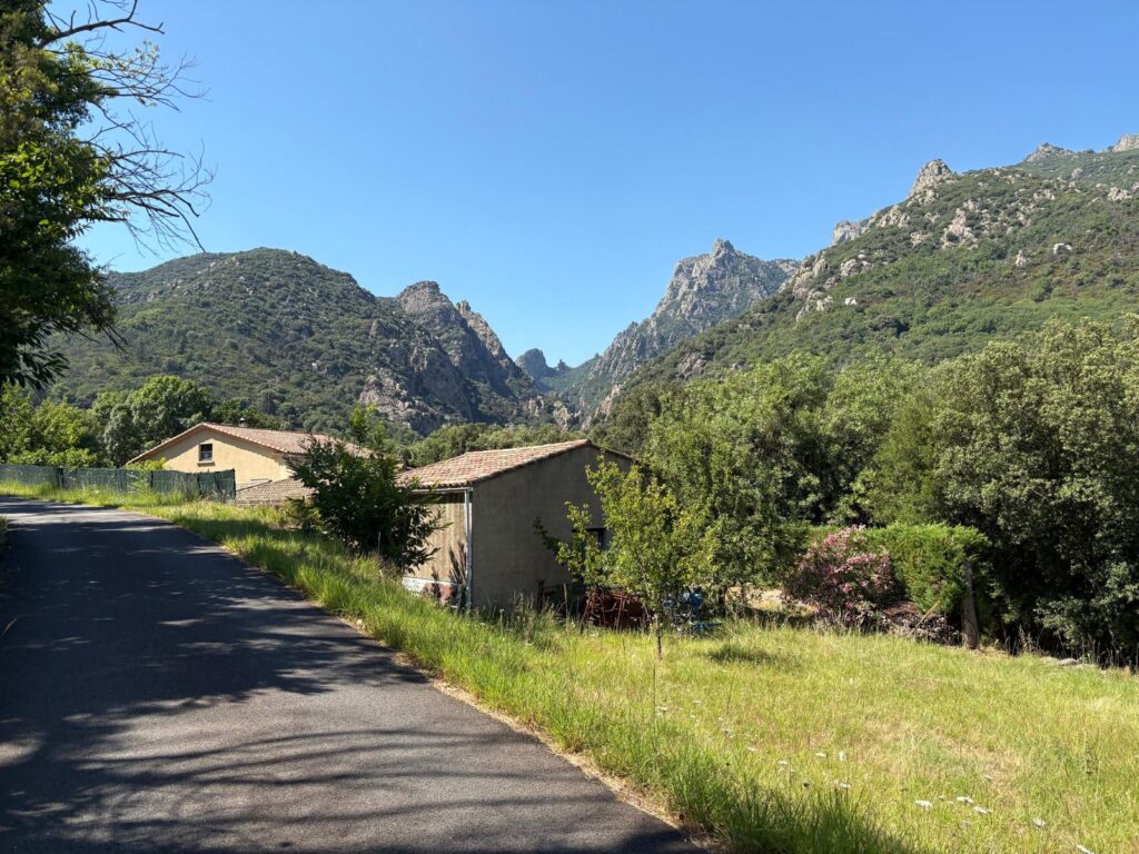
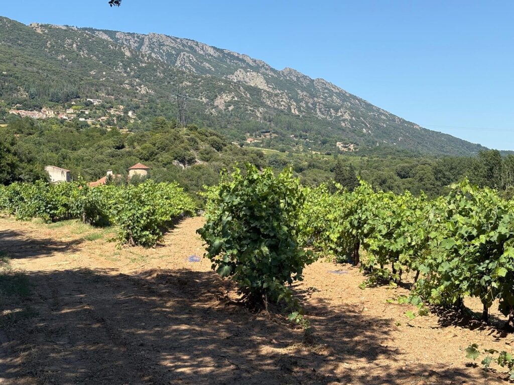
We began our walk in Mons, a little historic village in the Hérault. A little note on geography: the Hérault is a department situated in the Occitania region (l’Occitanie in French). It’s also within the Minervois, which is a wine-growing region. Anyway, this is where we were staying so it’s where we began. Mons sits just above the bigger village of Mons-la-Trivalle, which is bisected by the former railway we’re looking for.Some of the vineyards of the Minervois. It’s part of the Languedoc-Rousillon wine region, and produces red wines.A little bit further downhill, we find what we are looking for. This is the PassaPaïs. Now a walking and cycling path, from about 1880 to the 1970s a passenger railway passed along here. It covers about 80 KM in total, of which we are only seeing a couple. You can read more about it here (in French) or here (in English but a bit out of date).A bit more of the scenery for you.Just before arriving in Olargues, we cross this 1889 bridge. 1889, like the Eiffel Tower? Yes, and this is known locally as the ‘Eiffel Bridge’ or ‘Eiffel-Type Bridge’. It’s not though. The iron came from Eiffel workshops, but the man himself had subcontracted this project to another company (source here).
We Arrive in Olargues
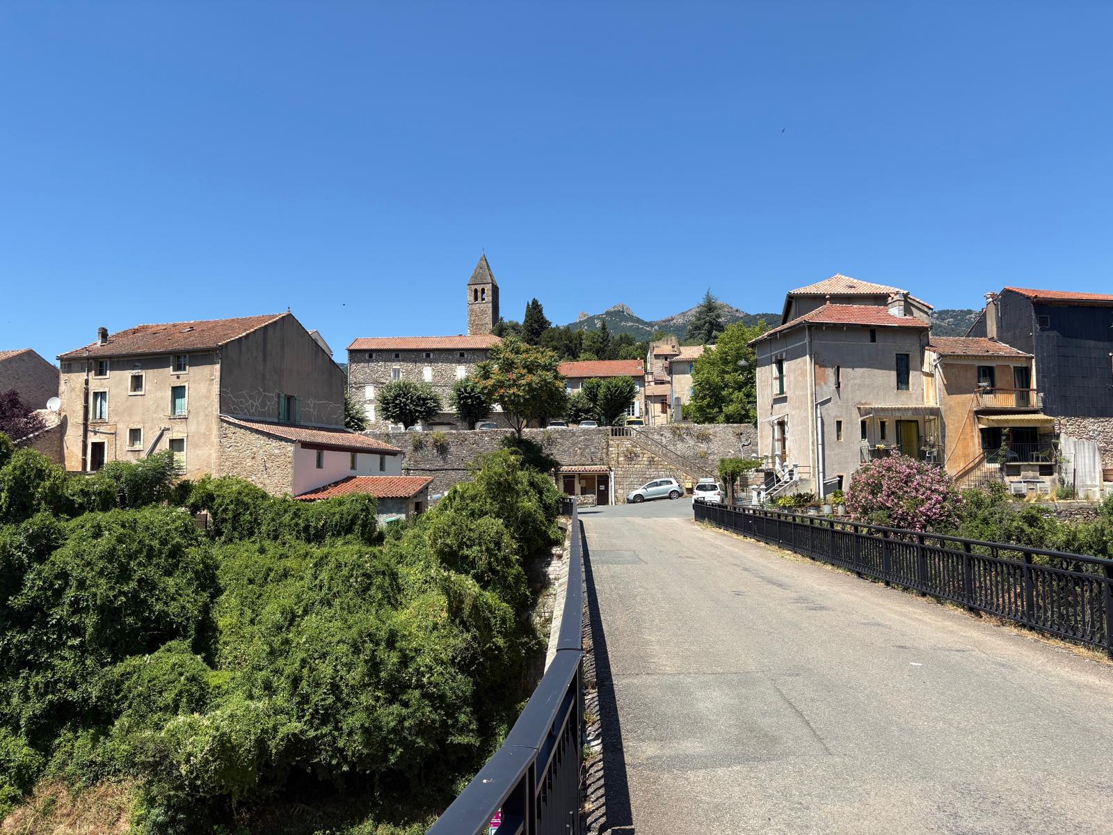
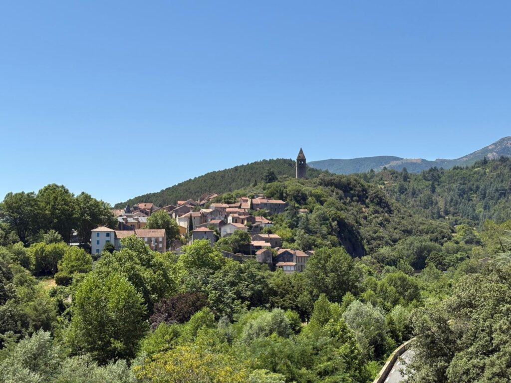
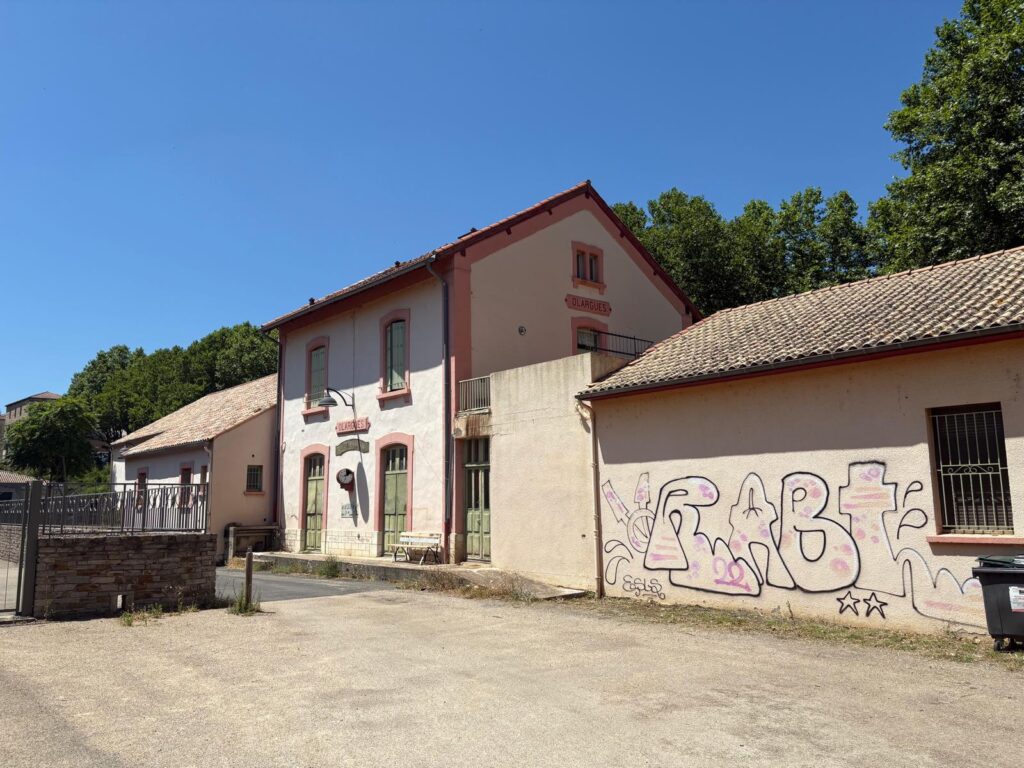
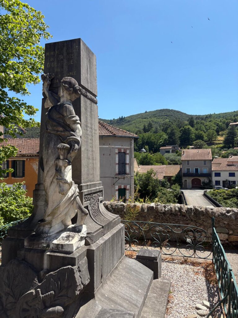
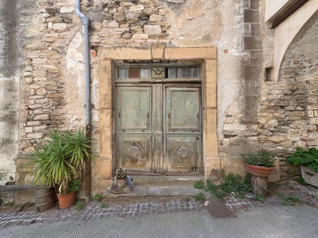
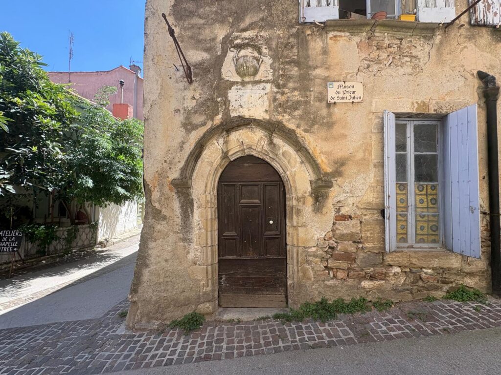
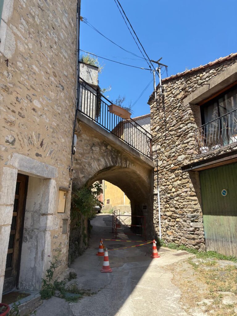
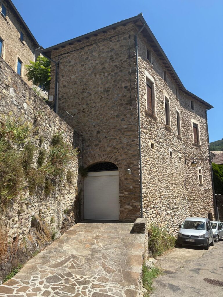
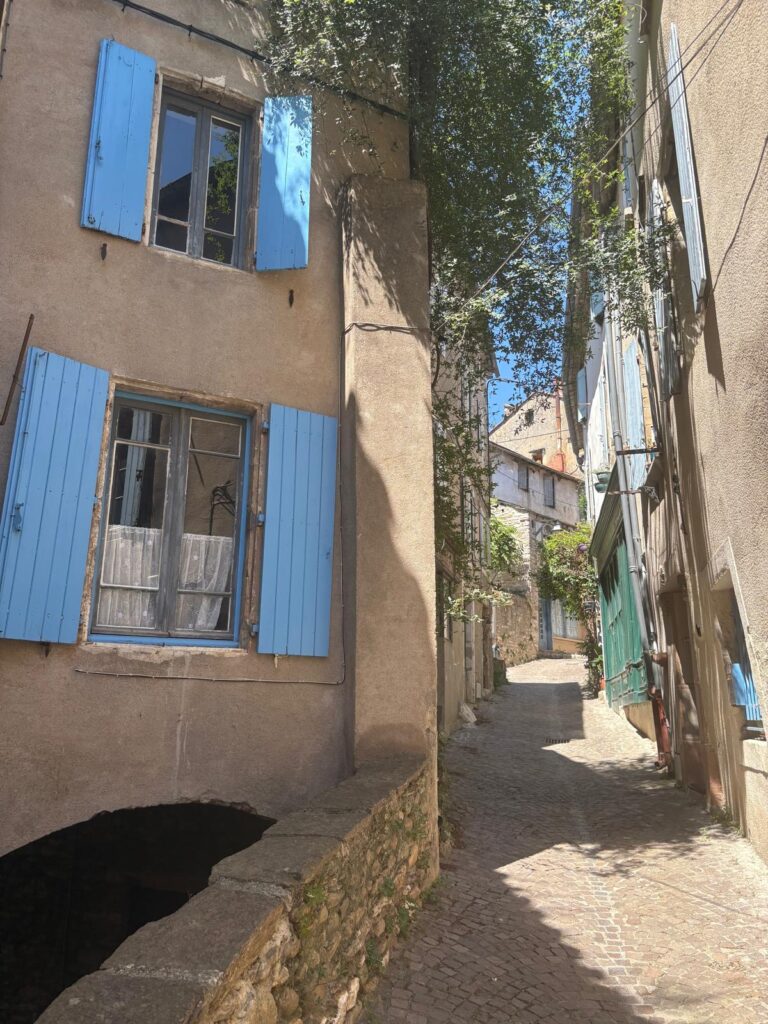
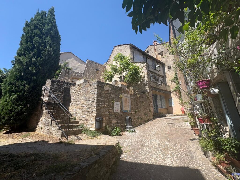
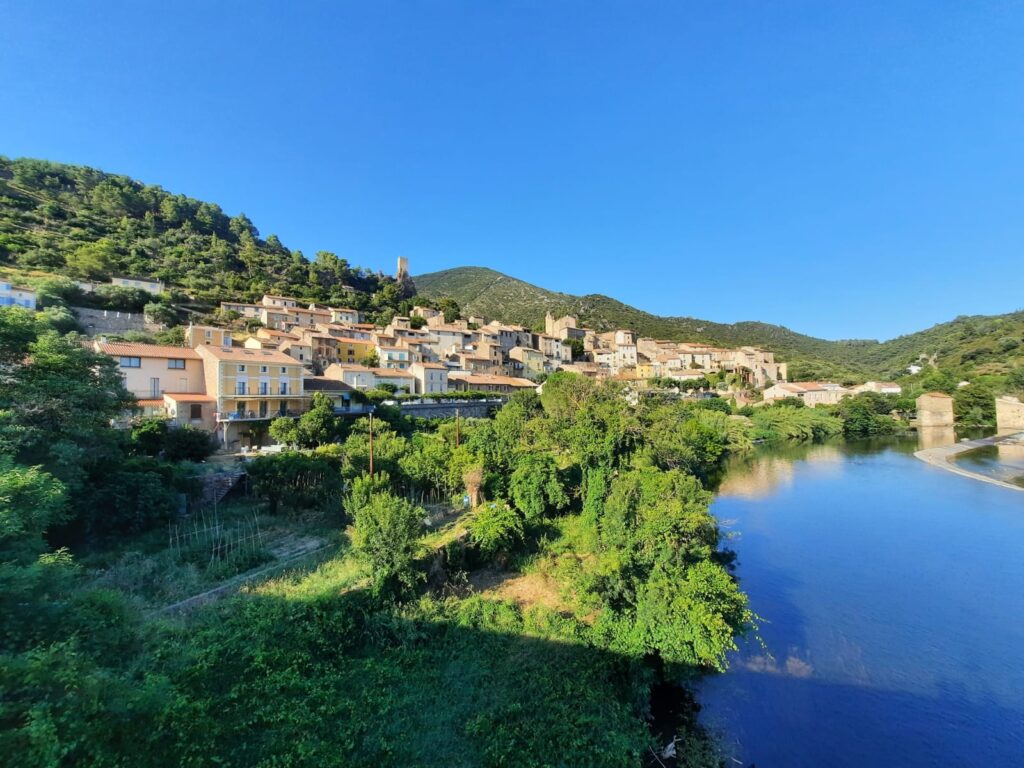
A first glimpse of Olargues from the bridge! Olargues often pops up in lists of France’s prettiest villages. It was long fortified, and still has the feel of a walled medieval town. But its history goes back further, with the Romans, Vandals and Visigoths having lived here. In the 11th century Olargues came under the authority of the Château of the Viscount of Minerve, and faced a period of war and unrest right through to the 18th century. Once again, poverty and hardship have the later upside of historic preservation!Fittingly, we bid farewell to the former railway at what was once Olargue’s station, just below the town. If you’re as silly as us and arrive when most businesses are closed for the afternoon, nearby hotel/restaurant Laissac is your best bet.The Salterton Arts Review always likes to find out about the history of a location, and ensure no stones are unturned when it comes to points of interest. To achieve that in Olargues, I downloaded an app: Circuits Minervois-Caroux. It’s available on Apple and Android, and nominally in English. One of their History Tours is all about Olargues. This photo is taken in the Plan du Verdier, the village’s main square. The app tells us its still used for community events, but when we visited it was masquerading as a car park. So here’s the village’s war memorial, and a view back to one of the entrances when this was a walled village: the Pourtalet.As described, a very medieval feel.Before there was a medieval village here there was a priory, right about in this spot, rue du Balad.More recently, I spot signs of masonic activity behind this attractive façade. This building is almost as old as the medieval iteration of Olargues, dating to the 12th century. Above its door, you can just about make out the village’s emblem, a (normally golden) round pot.
From the Walls to the Church
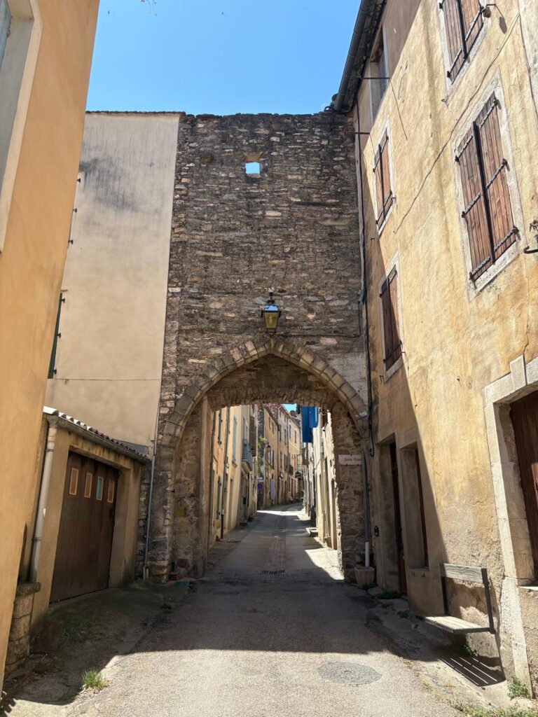
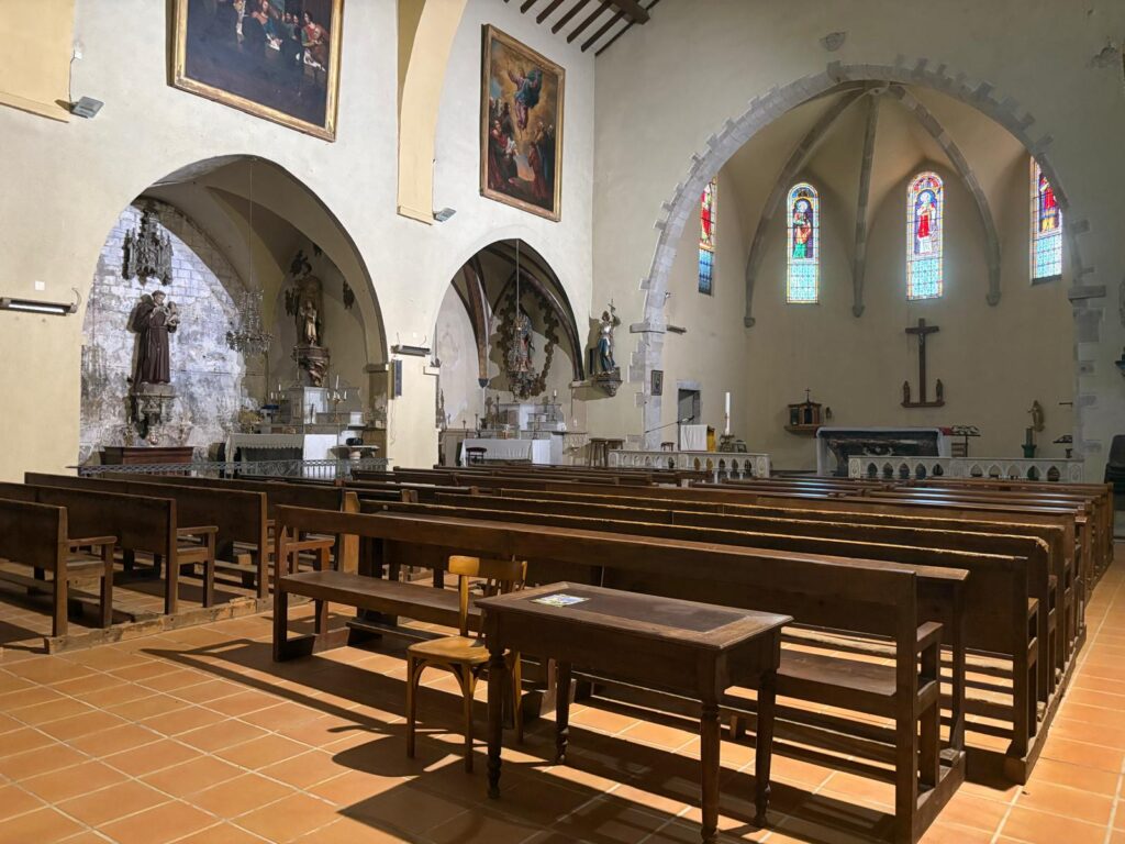
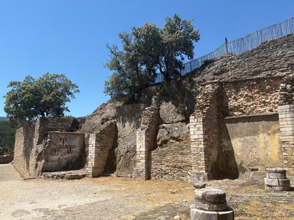
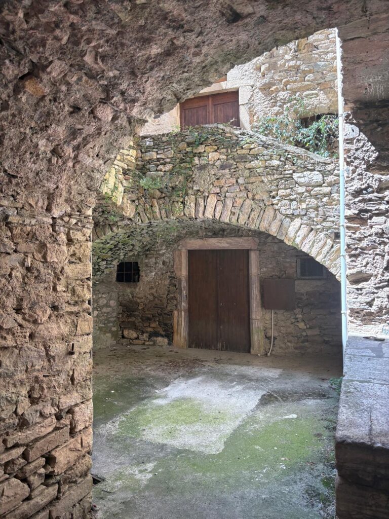
Here you have, viewed from opposite sides, a fragment of the ramparts of Olargues. This was the Porte Neuve, one of the main gates. The app tells me it used to have a portcullis and drawbridge, which you can just about imagine in the second image.More evidence of the fortifications that once were.The app took us on a small detour here, which annoyed the Urban Geographer no end as he was hot and tired already. But the interior of l’Église Saint-Laurent was cool and welcoming. Or the porch at least, as you can’t visit the rest outside of services (I presume, unless this was also a siesta situation). But this wasn’t the original Église Saint-Laurent. We’re about to see that, up the hill.
Up the Hill and Down Again
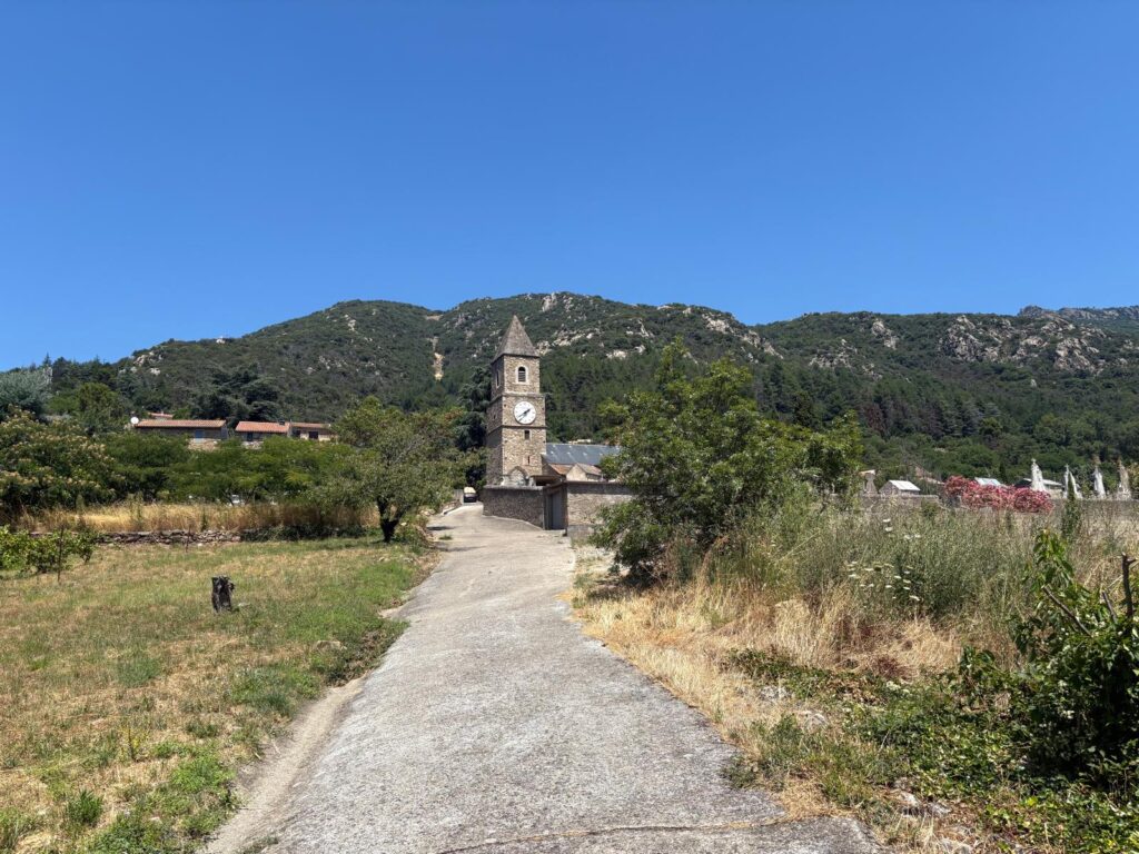
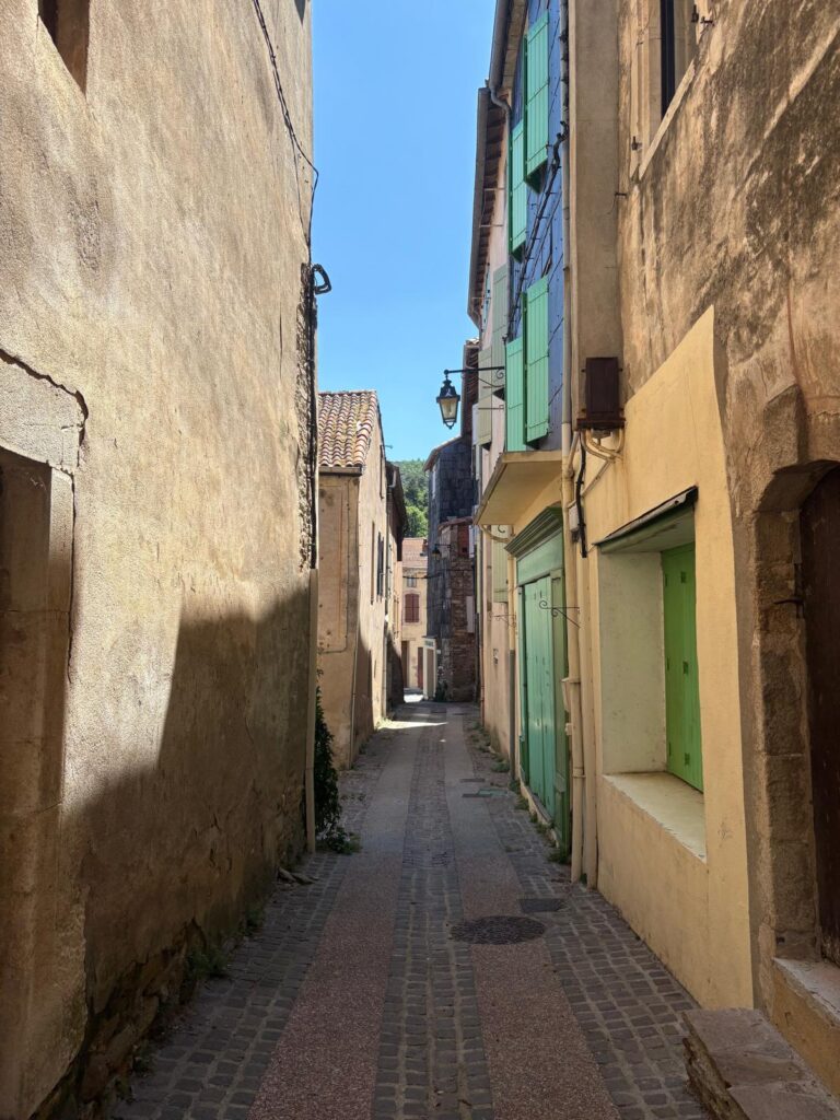
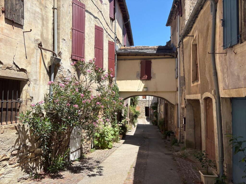
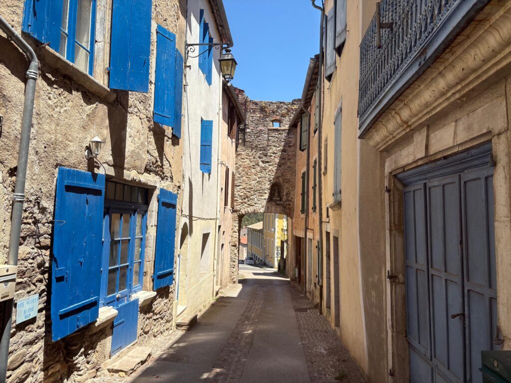
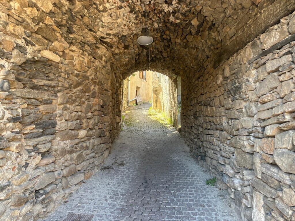
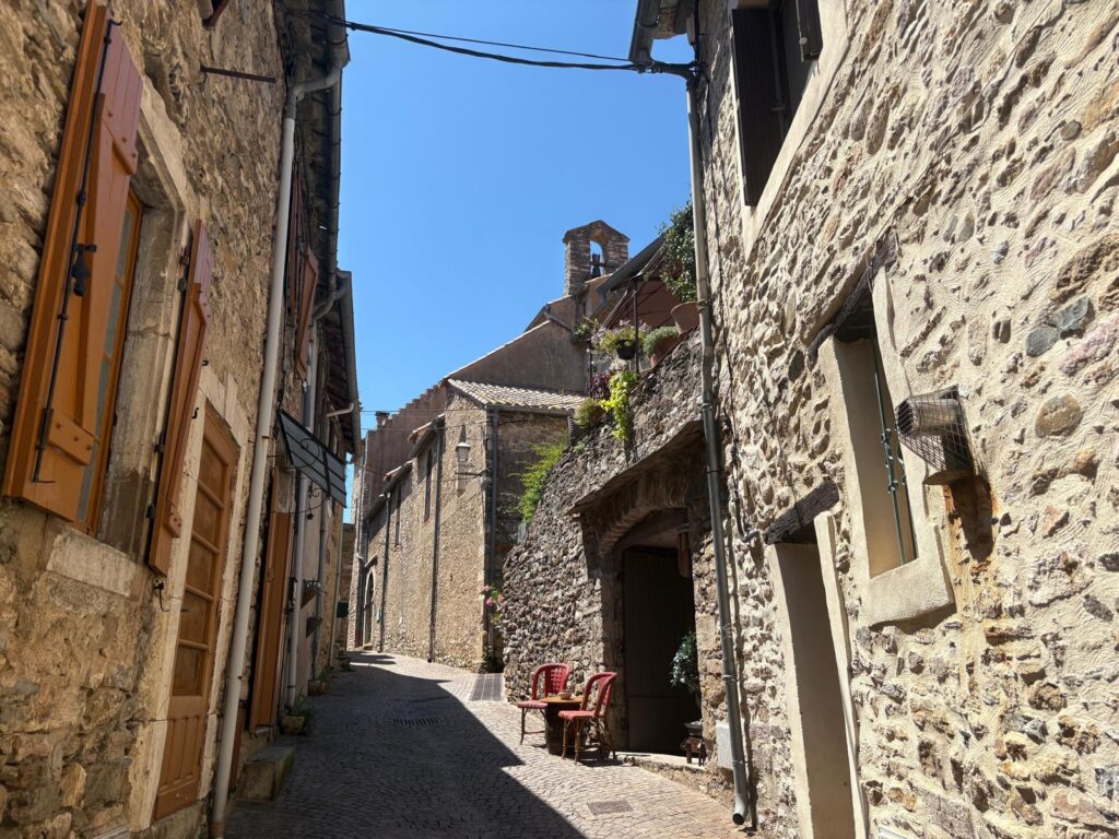
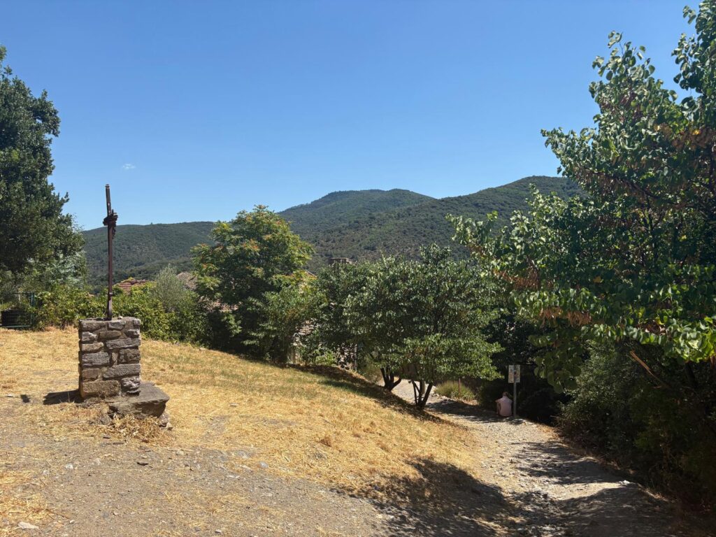
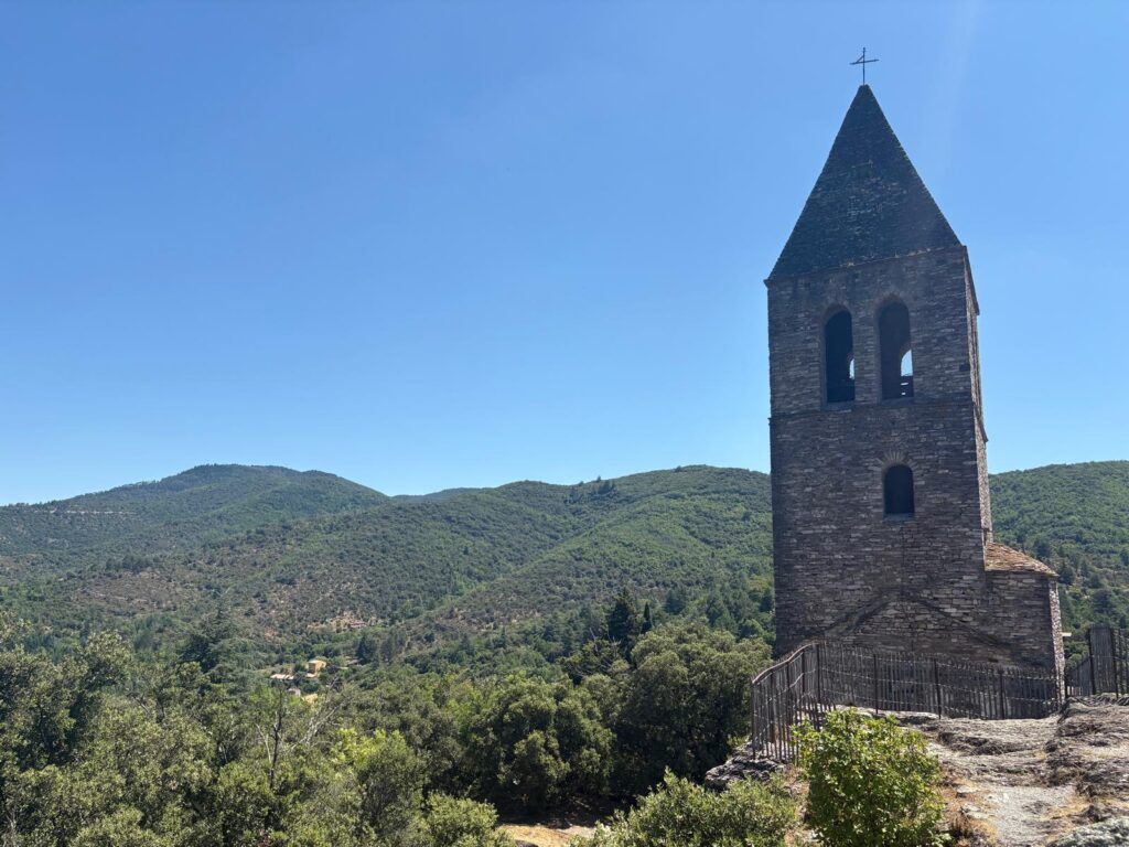
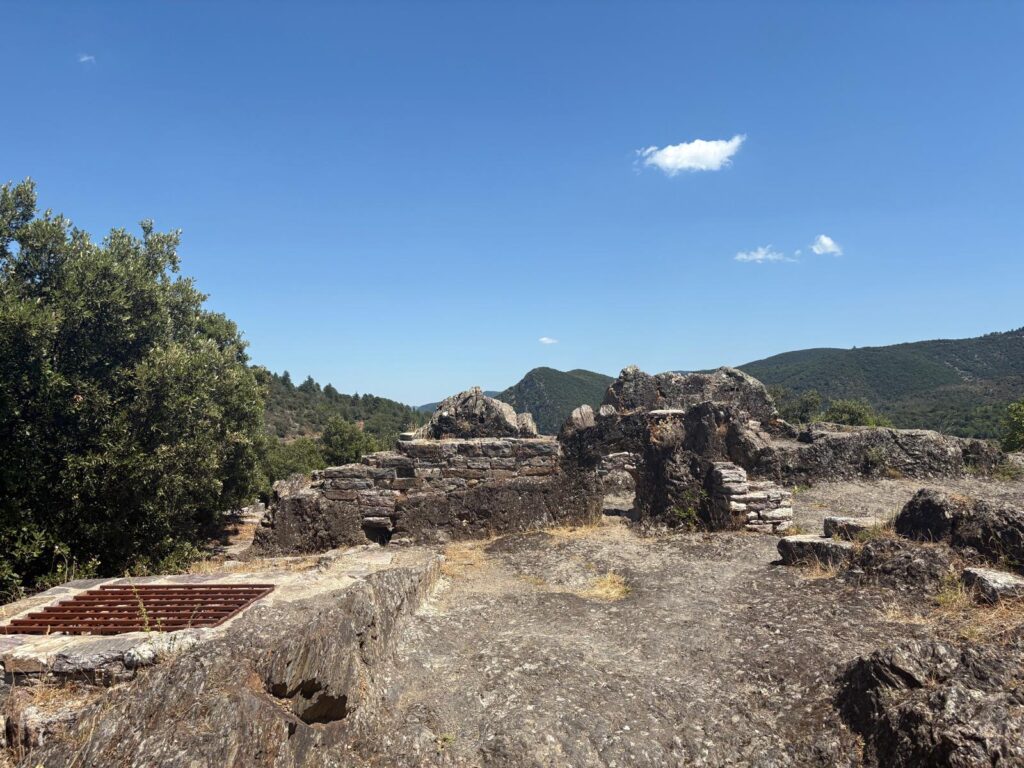
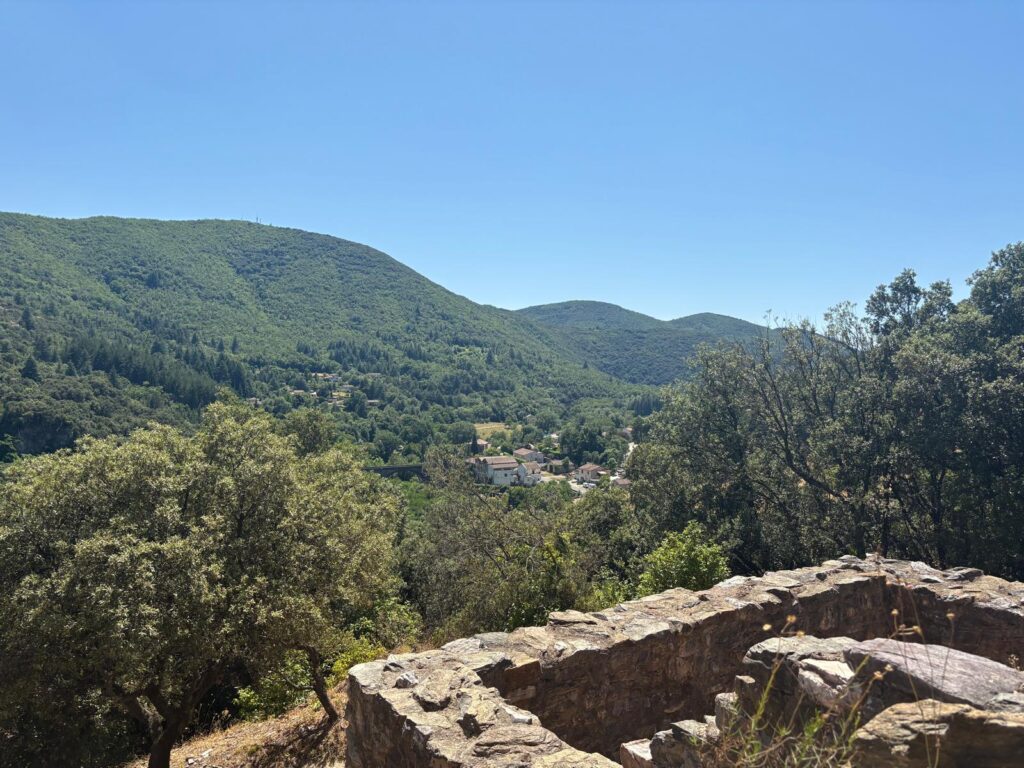
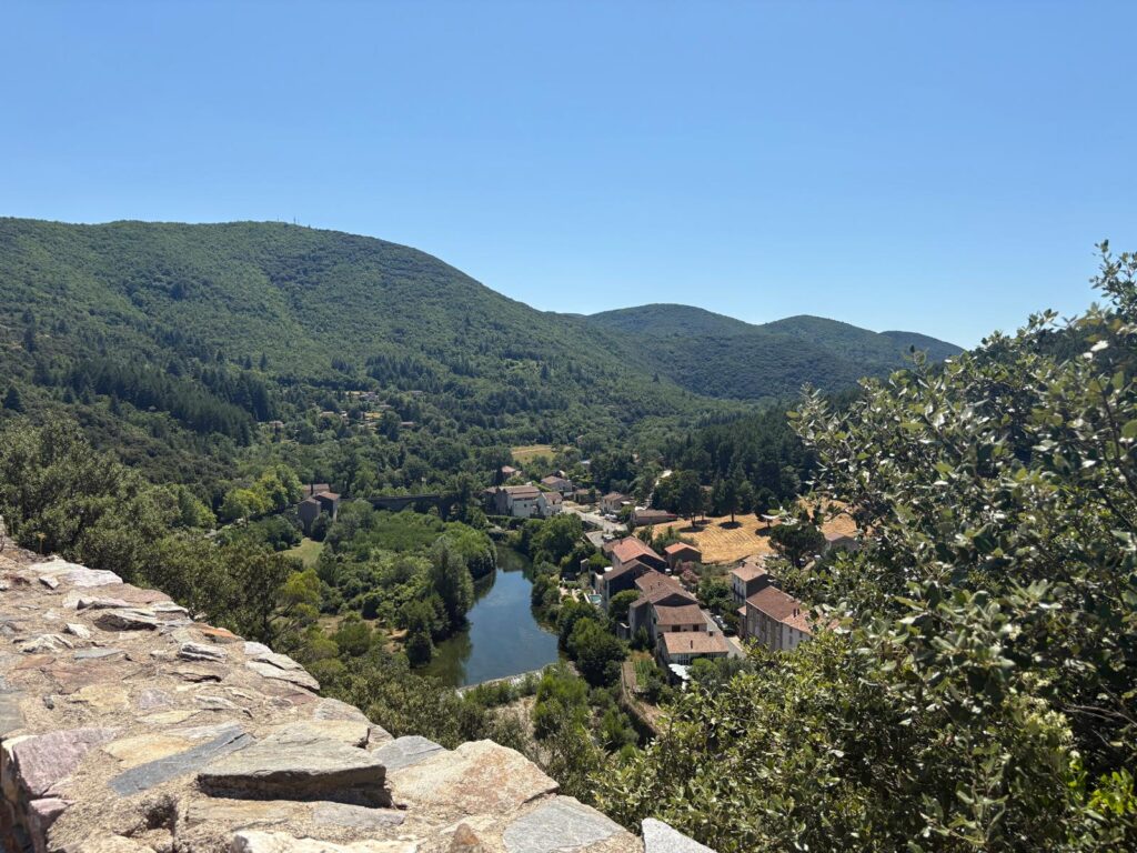
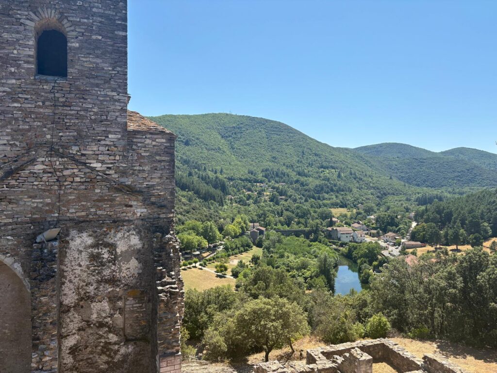
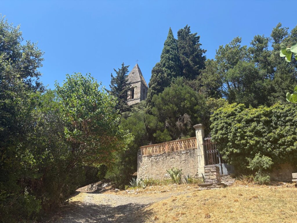
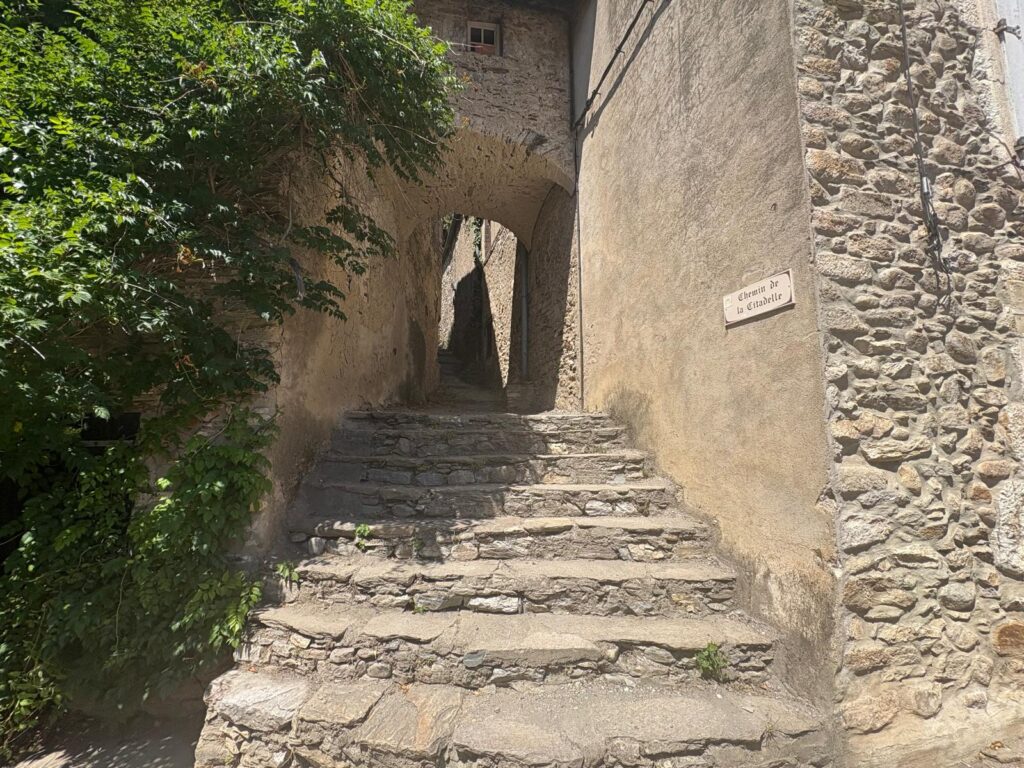
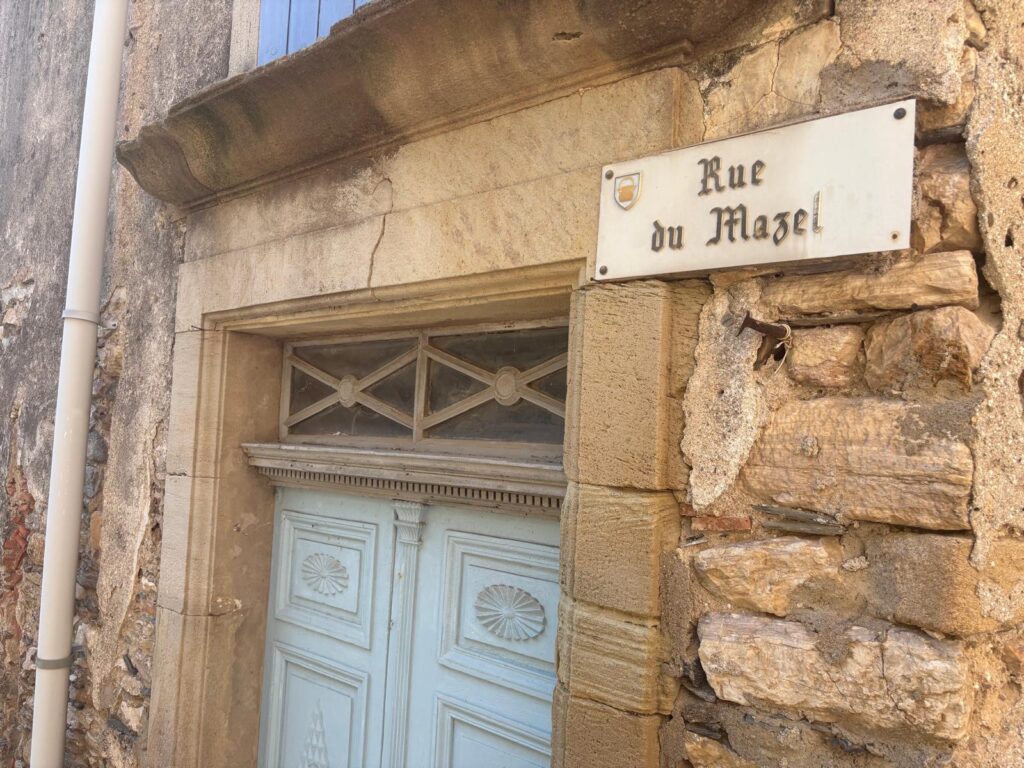
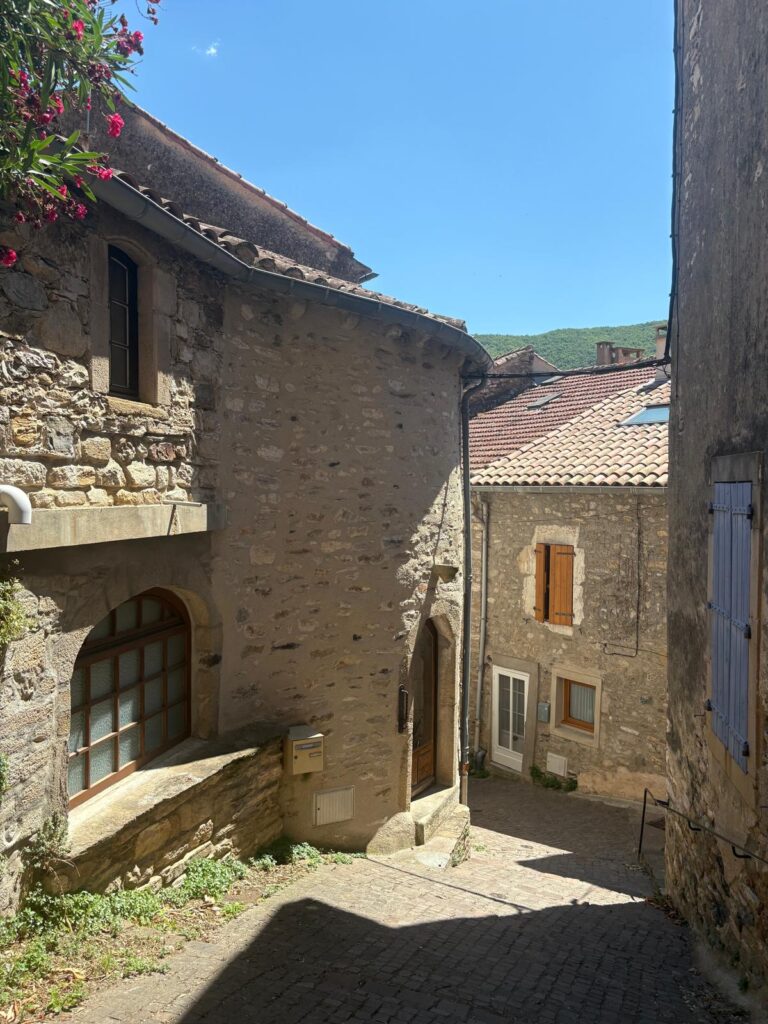
I left the Urban Geographer sitting under a bush (I’m not kidding, there he is by that signpost) and continued on up the hill.Here is the original Église Saint-Laurent. Or its belfry at least, which is all that is left. This is a Romanesque church (12th-13th centuries), and sits atop Olargues as part of what was once the citadel (castrum in Occitane). Interestingly, before it became a church, this same spot was the site of the castle’s dungeon. Both the castle and the church were ruined in the 15th century.The remainder of the citadel is now ruins. Very minimal signage and many places to break an ankle, but fun if you like archaeology as much as I do.The 360 degree views from up here are stunning. That’s the Jaur, down below, which we crossed earlier on the “Eiffel” Bridge.Goodbye to the church and citadel as I head back downhill and collect the Urban Geographer.Le Chemin de la Citadelle (the Citadel Path) is wonderfully medieval.A little further on, the rue de Mazel is a reminder of that long period of unrest. Mazel means butchery, and refers to the capture of the town during the Wars of Religion (1562-1598). The rue des Pilles Antiques (Street of Ancient Pillages) likewise.Let’s continue on down through more medieval streets.
Olargues and the Jaur
Another Romanesque construction, this handsome bridge dates to the 12th century, and was restored in 1758. Over the years it’s been called le Pont de la Pierre (the Stone Bridge), le Pont Vieux (the Old Bridge) and now le Pont du Diable (the Devil’s Bridge). The name could either refer to the fact that the bridge necessitated payment of a toll whereas fording the river had been free, or to a legend common to many bridges of the same name that the architect or townspeople had made a pact with the Devil in order to construct the bridge. You can see another image of it near the top of the post.Any water source that could be used to power a mill in the medieval period was valuable. And we can see down by the river that the buildings are more practical than residential. Grain and oil are among the products milled by the residents of Olargues. Living close to a river isn’t all free power, though. The village has survived numerous floods which destroyed flocks and fields. The flood of 1723 carried off trees and filled the entire valley, one of the Jaur’s tributaries reaching 30 feet in height. The app mentioned remaining visible marks from another major flood in 1875, but I didn’t spot them.We now follow what looks to be a former commercial street back up the hill.We have arrived at l’Espace des Vicomtes (Viscounts’ Square), where a stately home must once have stood. Even after the Barons of Olargues stopped residing here, they kept a foothold so they could check on their subjects, dispense justice, and deal with administrative matters.
A Museum, and Goodbye to Olargues
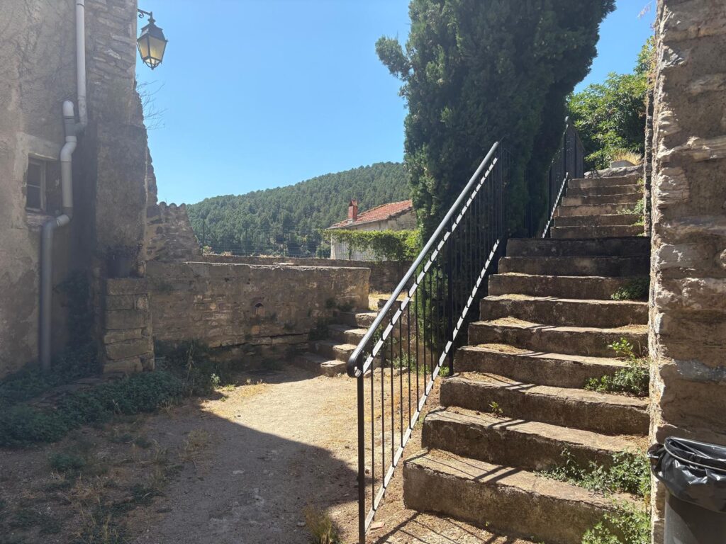
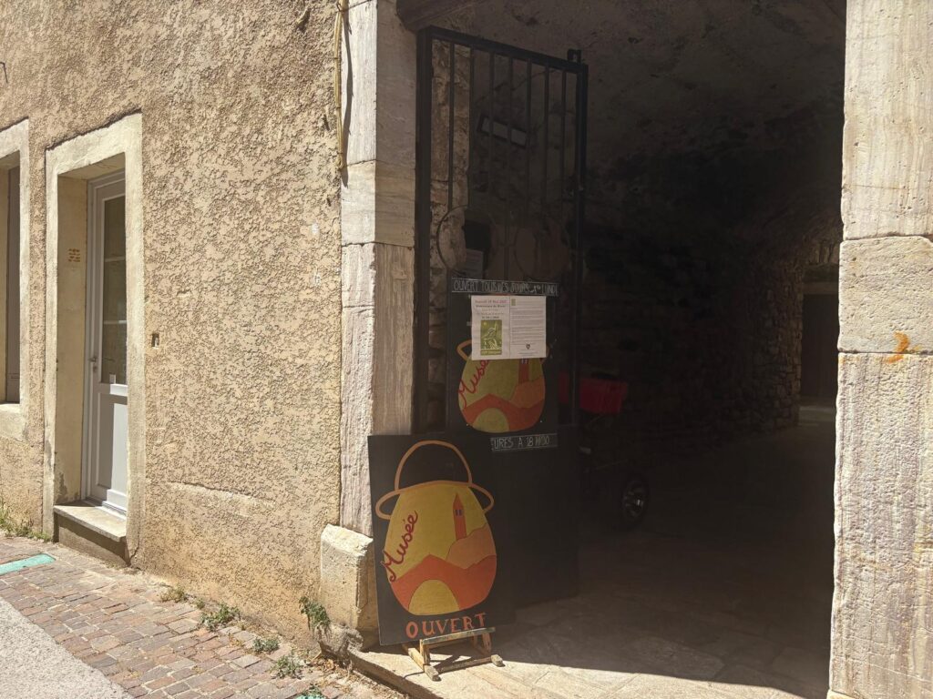
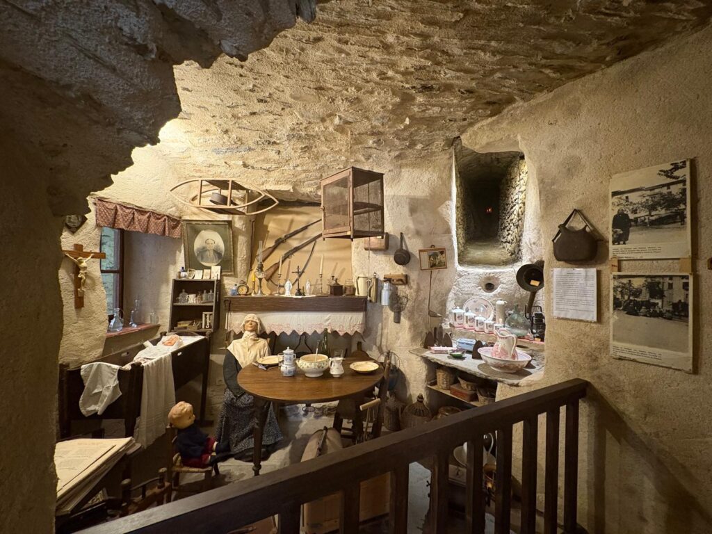
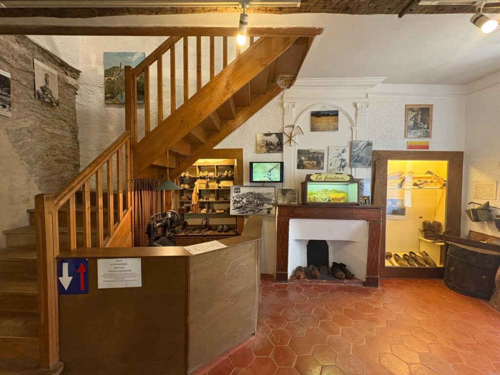
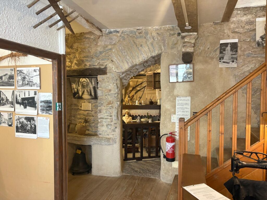
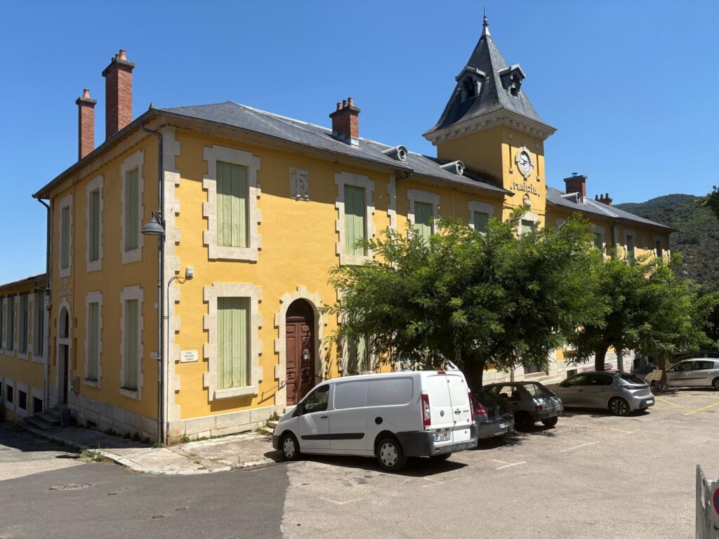
Then, after finding a nice cool spot to drop off the Urban Geographer for another little rest (on a stairwell that formed part of the local headquarters of the Knights Hospitaller of the Order of St John)……I visited the local museum, le Musée d’Art et Traditions Populaires (the Museum of Popular Art and Traditions). I’ve done a short post on the museum here, but suffice it to say it’s reasonably charming and informative. I learned about local customs and industries, including extensive chestnut farming in the region.We’ve seen everything suggested by the app now, so it’s time to wander down past the cheerful town hall to get a drink at le restaurant Laissac (still the only place open). OK, an ice cream too, go on then.Back we go across the “Eiffel” Bridge.And along the old railway once more until we reach Mons. As I write this post almost a month after this expedition, the Urban Geographer has just about forgiven me for dragging him around in the heat. Hopefully by the time it’s posted, he’ll have forgotten and be ready for the next hare-brained scheme!
Other Things to See and Do Around Olargues
Let’s be honest, I don’t think you are going to go all the way to the Hérault to follow in my illustrious footsteps. So what else can I do to entice you to this beautiful region of France? For starters, I can share some of the other wonderful things to see and do in the immediate area. Please note: unless you are going to be cycling, you’ll need a car. Public transport is practically non-existent around here.
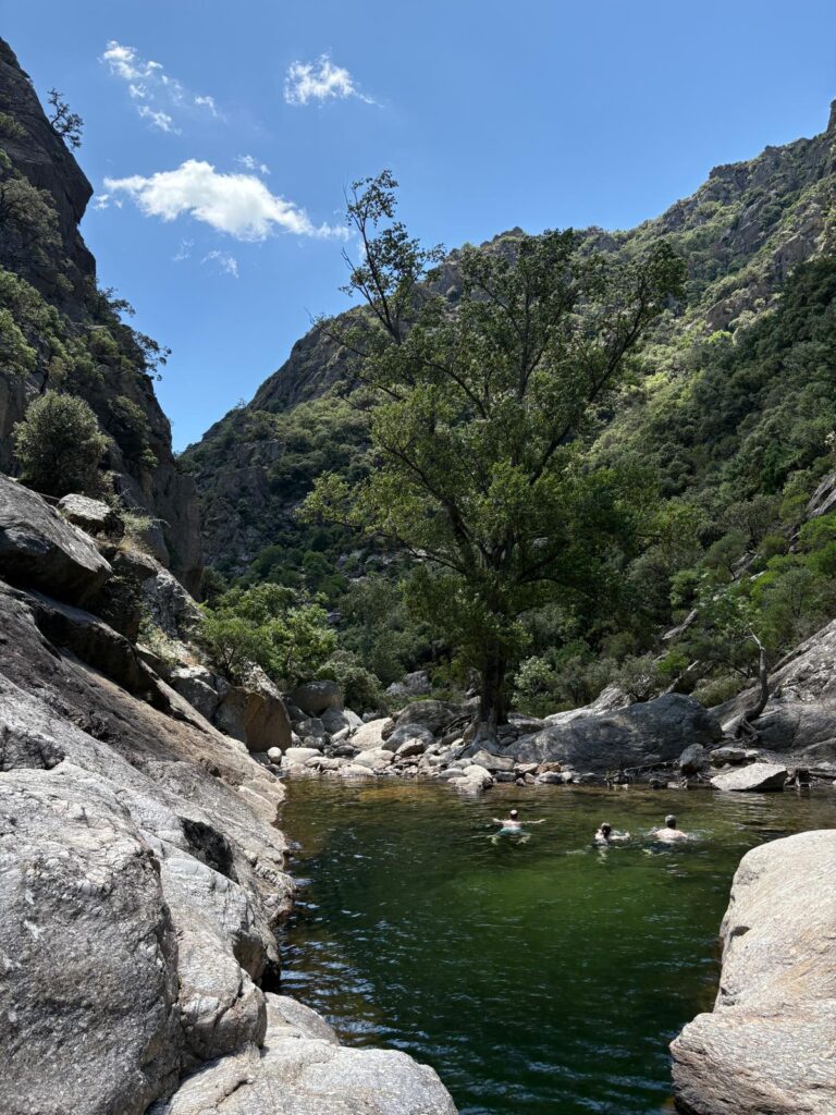
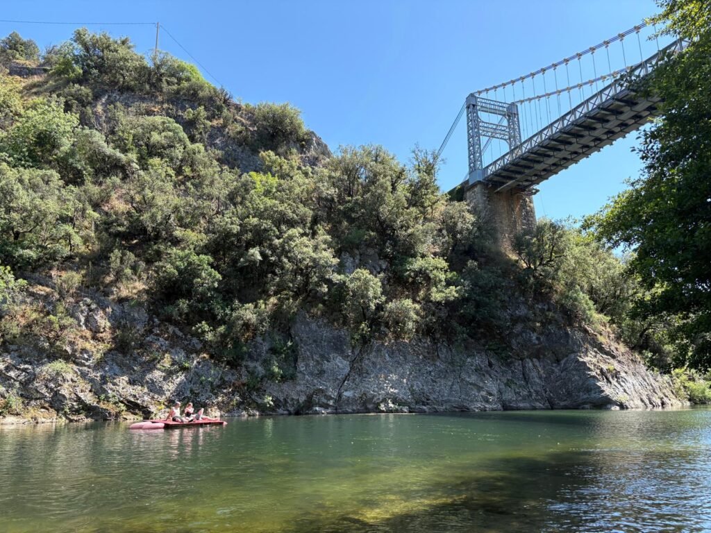
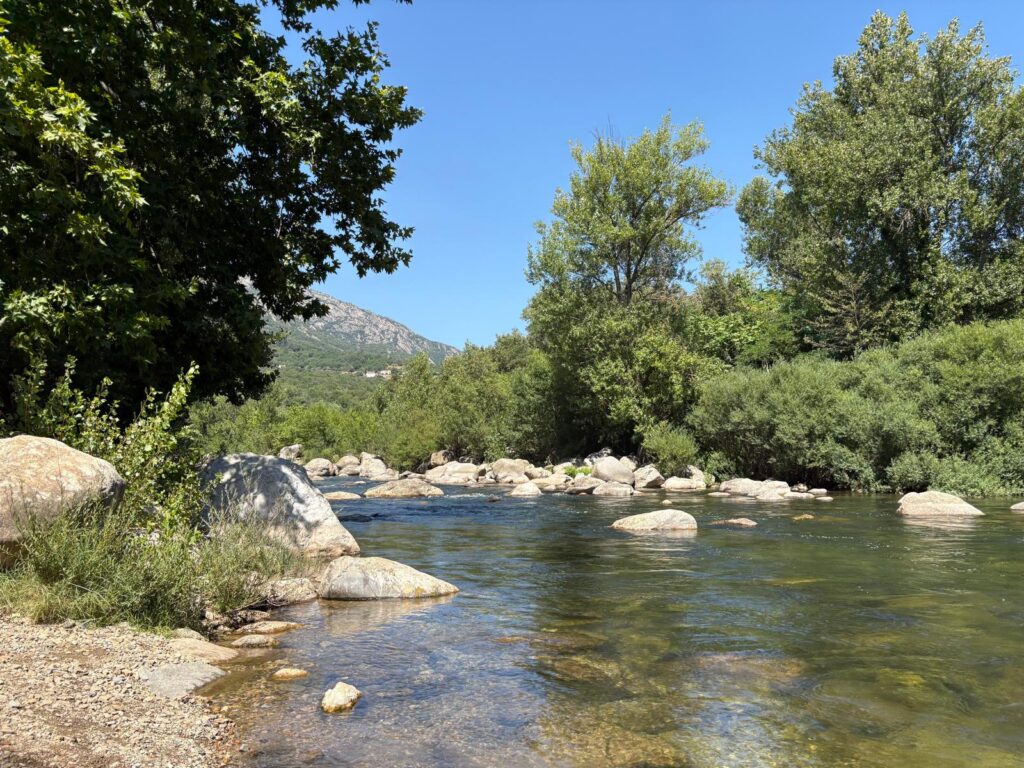
There are numerous options for outdoor activities in the region, including hiking, rock climbing, and swimming. You can do all three in the Gorges d’Héric, which is within walking distance of Olargues. There’s a snack bar at each end: we only made it to the one at the beginning. The only cost to access would be parking, but many of the pools involve scrambling down rocks to access so do be careful.An alternative option for swimming is the Orb, another local river. There are also companies offering kayak hire or escorted kayaking trips depending on the water levels and therefore the skill needed to traverse different segments.Or you can stick with cultural heritage rather than natural heritage, and explore more beautiful villages, some of them with Michelin-starred restaurants. Between that and the vineyards, you should easily be able to fill a short trip, or take your time and stay longer. Pictured is the village of Rochebrun. And so we bid à bientôt to Olargues and the Hérault.
Trending
Travelers' Map is loading... If you see this after your page is loaded completely, leafletJS files are missing.
2 thoughts on “A Visit To Olargues”
You are so generous with your write-ups & photos, thank you!

You are so generous with your write-ups & photos, thank you!
Thank you so much, you’re very kind!