Long-time London resident and avid museum and theatre-goer. I started this blog in 2014, and got serious about it in 2020 when I realised how much I missed arts and culture during lockdowns. I go to a lot more events than anyone would think is sensible, and love sharing my thoughts in the forms of reviews, the occasional thought piece, and travel recommendations when I leave my London HQ.
A walk around the historic Rotherhithe Peninsula reveals tales of pilgrims, celebrity Victorian architects and post-war decline and regeneration. Plenty of photos to guide you should you want to follow the walk yourself!
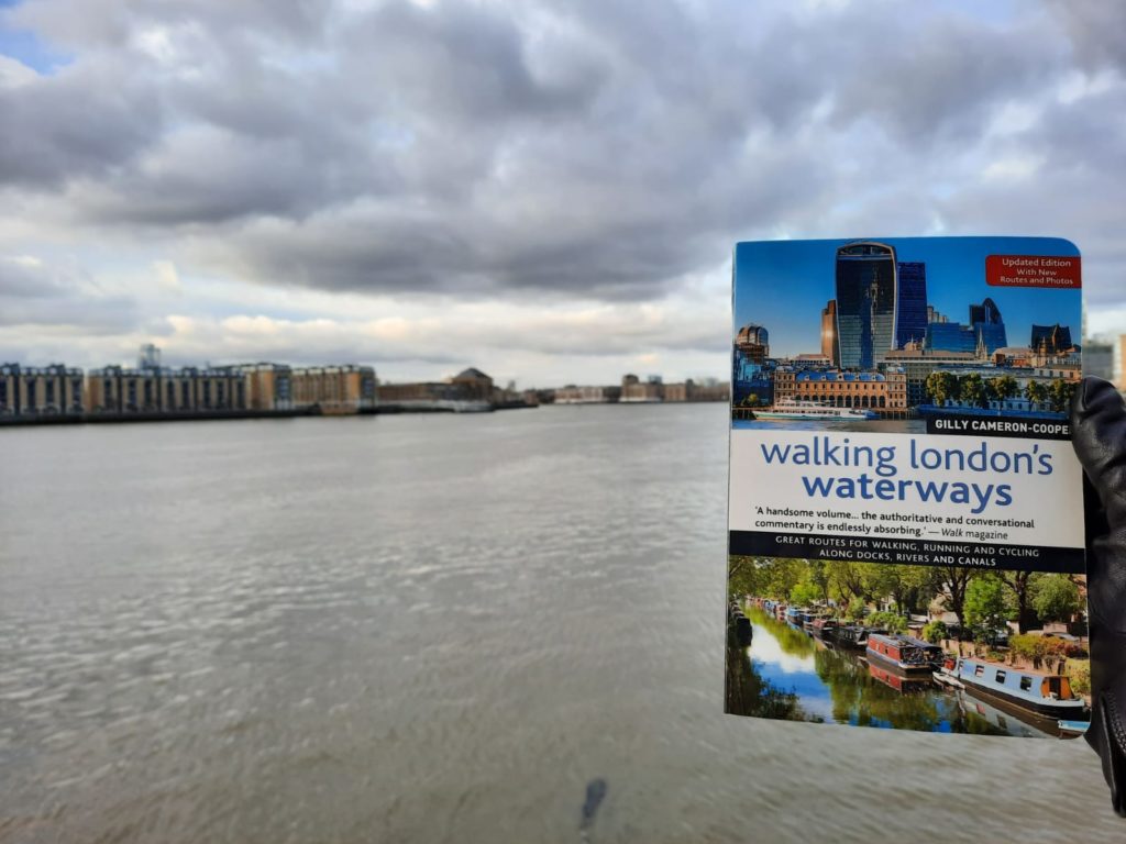
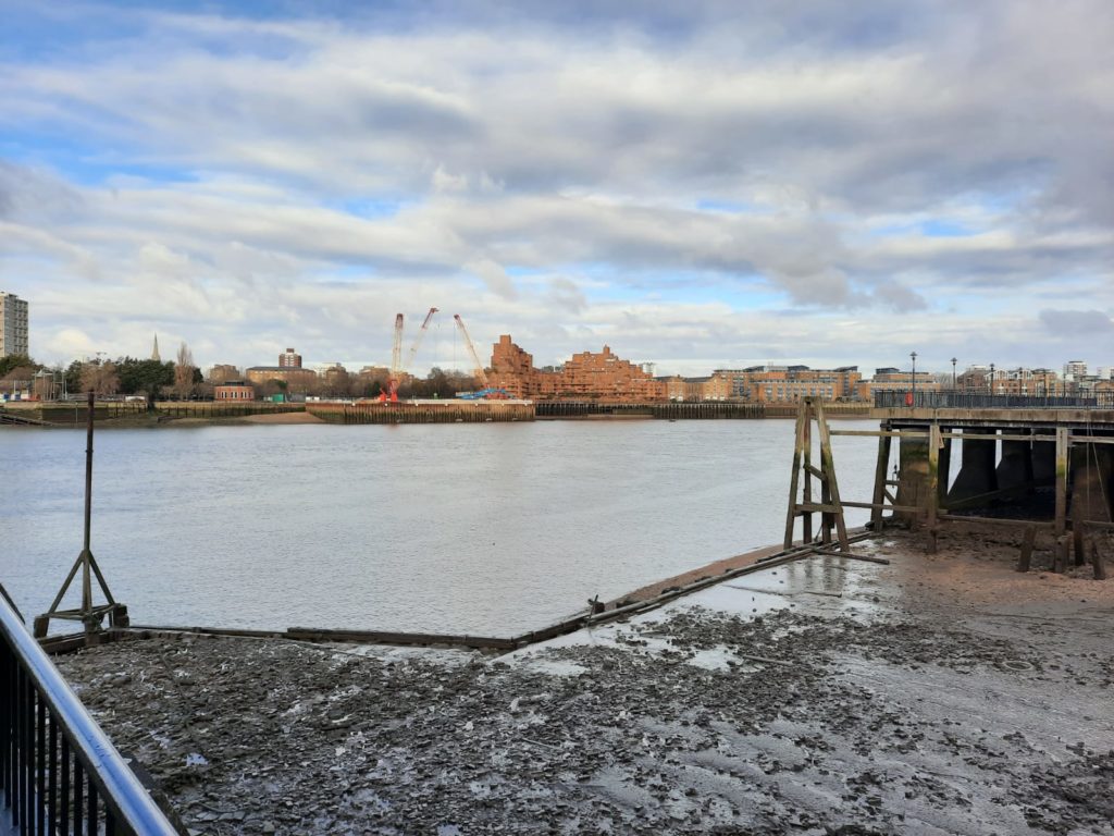
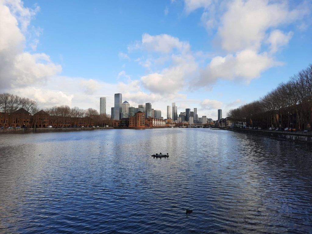
Today’s walk comes once again from Walking London’s Waterways by Gilly Cameron-Cooper (although this photo was taken from the other side of the Thames, looking over towards Rotherhithe).
A Counterpart to Canary Wharf
We continue our series of heritage walks today with a journey over the Thames to the Rotherhithe Peninsula. Like our recent walk from Wapping to Westferry via Canary Wharf, this walk takes in a lot of history if you know where to look. Some very few parts of the docks are still visible. Others now hide under residential buildings or even woodlands. There are references to early pilgrims who departed from London in search of religious freedom. And even a museum dedicated to the Victorian era’s most famous family of engineers.
Rotherhithe was once a fishing village on the banks of the Thames. Its name comes from the Anglo Saxon Hrȳðer-hȳð (no, I can’t pronounce it either) meaning a landing place for cattle. More generally, a hithe is a small landing place for ships or boats. By the 18th Century a number of shipyards had moved in; and by the 19th Century docks had taken over a lot of the peninsula. Like much of the Docklands there has been a big effort towards regeneration since the 1980s, so today there is more residential and green space than industrial or commercial heritage.
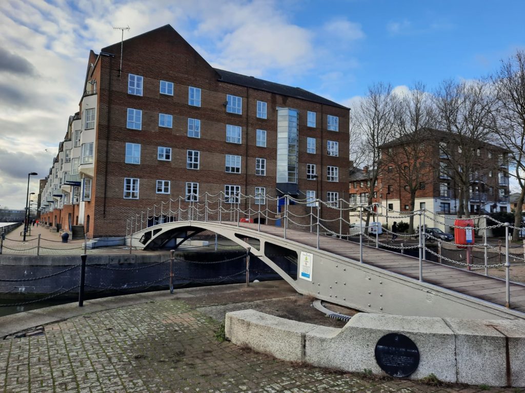
Historic Rotherhithe Walk: Rotherhithe Village
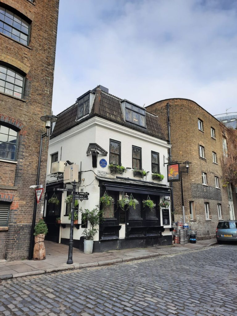
We start near Rotherhithe station. The Mayflower pub was once called the Spread Eagle. It changed its name to commemorate the sailing of the Mayflower from Rotherhithe in 1620, filled with pilgrims on their way to religious freedom in the New World. Captain Christopher Jones returned with the Mayflower to Rotherhithe, and is buried in the village. Fun fact – The Mayflower is the only UK pub licensed to sell US (why?) and UK postage stamps.
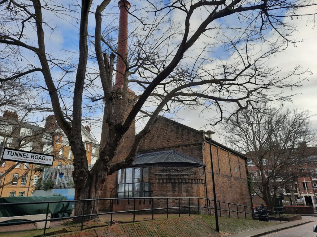
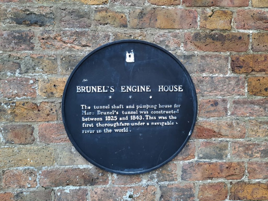
The Brunel Museum occupies an engine house from Sir Marc Brunel’s 1843 tunnel under the Thames, the first in the world under a navigable river. You will remember we saw the other end of the tunnel in Wapping on our walk to Westferry. As well as the engine house, there is access to a tunnel shaft where you can learn more about Brunel’s innovative engineering methods. I look forward to visiting when there isn’t a lockdown on!
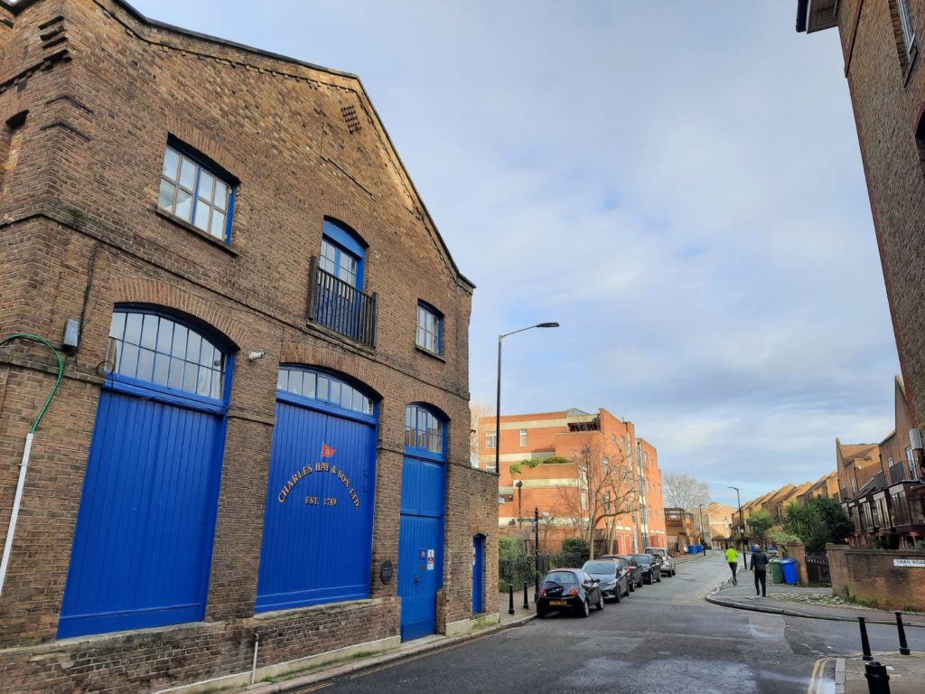
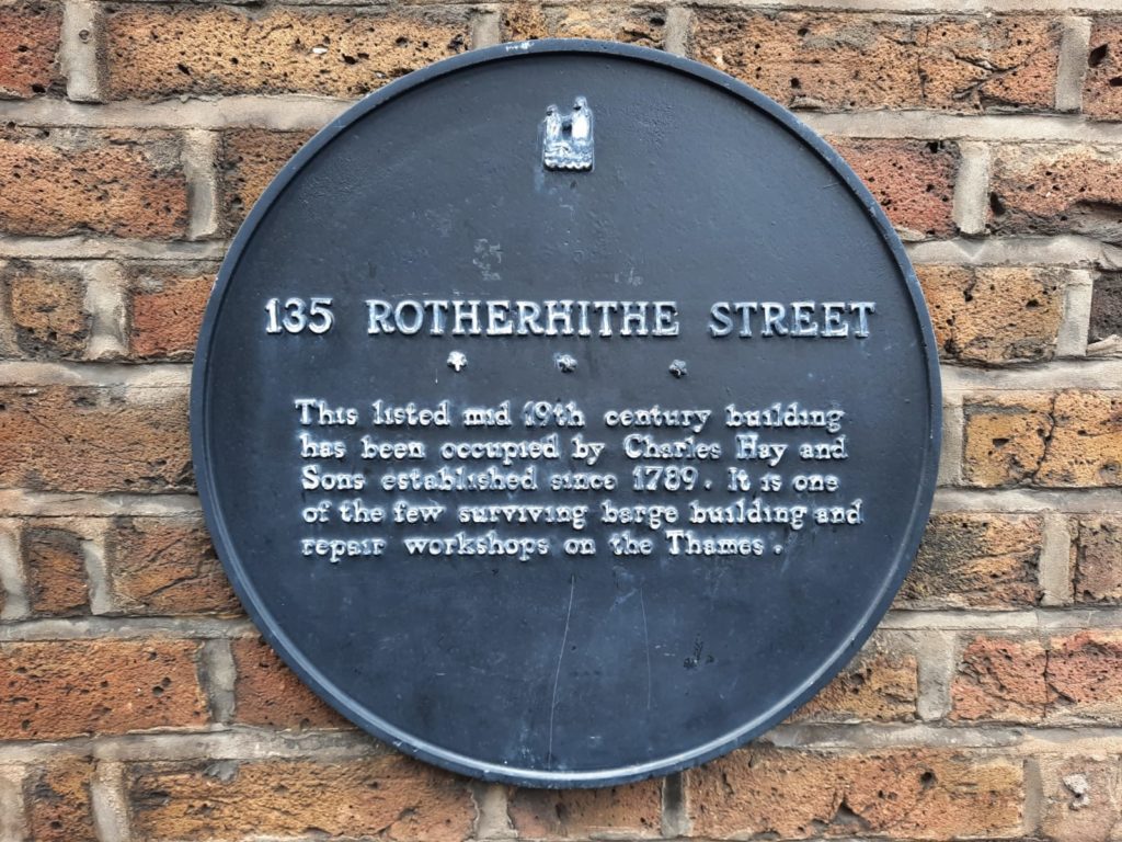
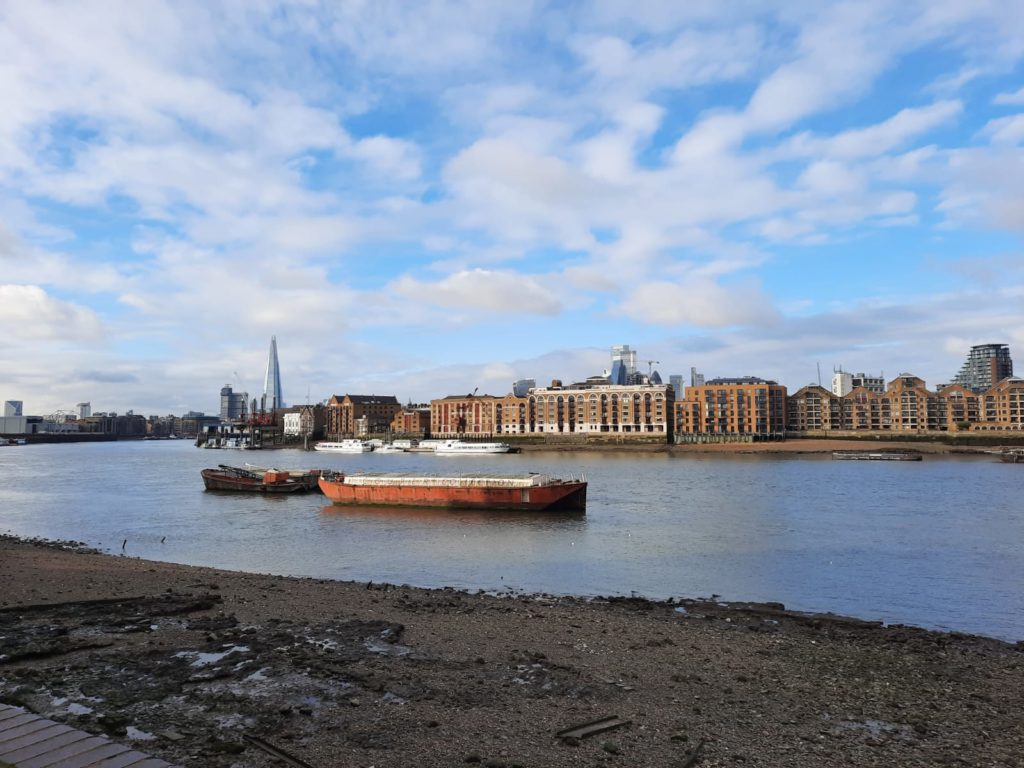
Just down Rotherhithe Street from the Brunel Museum is a business that is as old as the French Revolution! Or at least it would be if it wasn’t now apartments. But the building itself is a rare survival, as this plaque indicates.Our first glimpse of the Thames on this walk, looking towards Wapping.
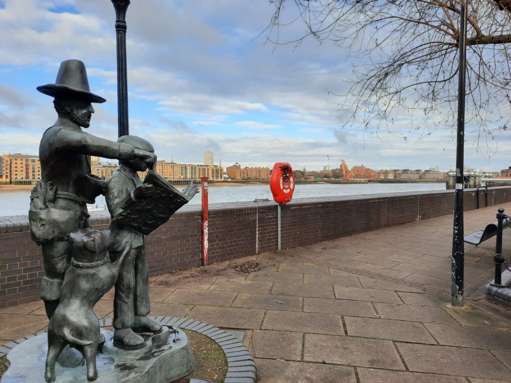
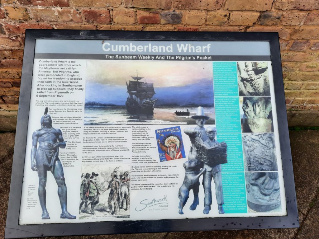
On the waterfront at Cumberland Wharf we find a statue of a Pilgrim father and son by Peter McLean. The information panel explains that this is actually the ghost of William Bradford, Governor of the New Plymouth Colony. Bradford is looking shocked as he learns in the newspaper what America has evolved into. Given recent events, I think that’s fair enough!One of the ventilation shafts for the Rotherhithe road tunnel. We saw the other one on a previous walk in Wapping near King Edward Memorial Park.
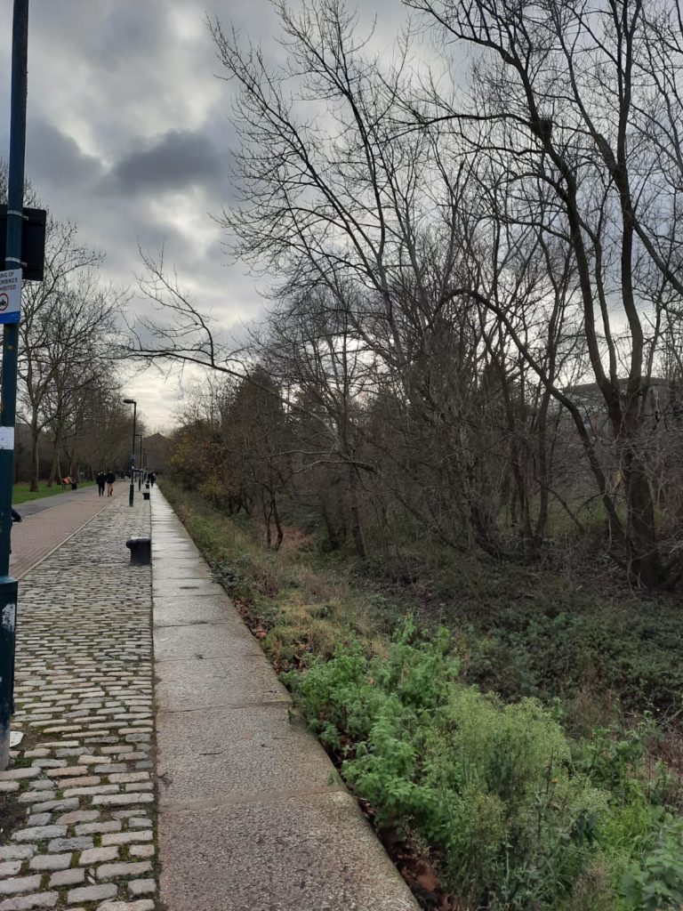
Historic Rotherhithe Walk: Waterfront and Russia Dock Woodland
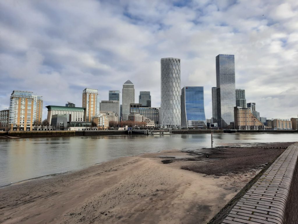
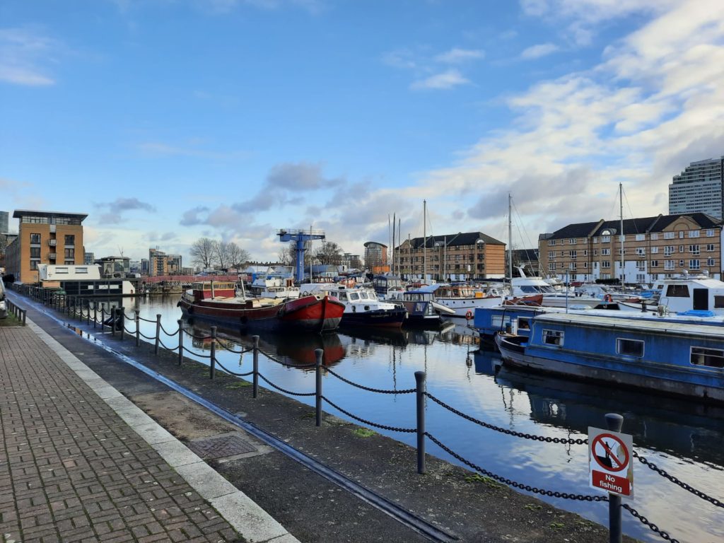
Low tide often reveals interesting aspects of the Docklands. Which inlets now have a concrete bed for example, and which have surviving wooden structures under the water. This peninsula once had numerous small inlets and docks: larger commercial docks later swallowed many of them, before becoming outdated and falling into disrepair. 423 of the 460 acres of docks on the Rotherhithe Peninsula were filled in after Surrey Docks were closed in the 1970s.A good view of Canary Wharf across the other side of the Thames.Surrey Docks Farm is currently closed (like everything). You can still click and collect orders from the farm shop to help them out during this tough time.
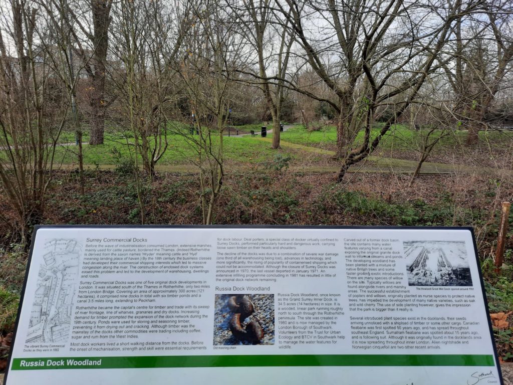
Russia Dock is most definitely one of those which have been filled in! It is now a woodland, but once the port for cargoes from Northern countries such as Russia. Timber, tar, oil and tallow were among the products which arrived here, as well as huge amounts of grain and dairy produce from Canada (ie. Canada Water, today surviving on in the name of the Underground station).If you look hard, you can still see that this was once a quay in Russia Dock. The cobbles and quayside bollards give it away, and there are also metal tracks where machinery used to run up and down.
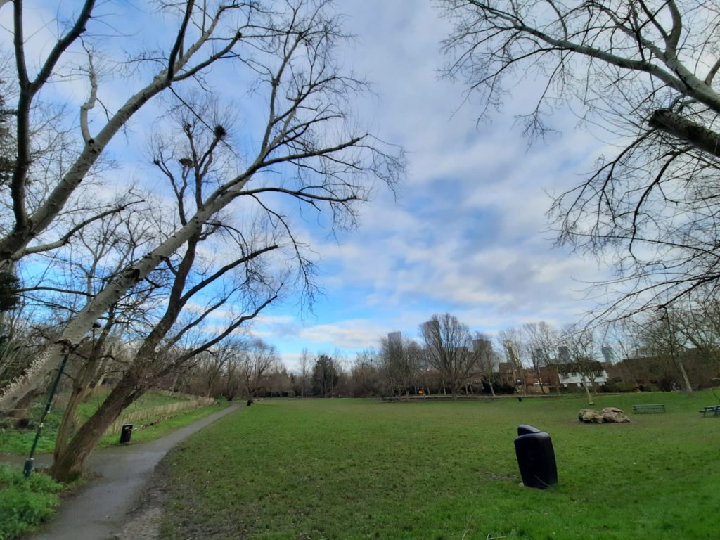
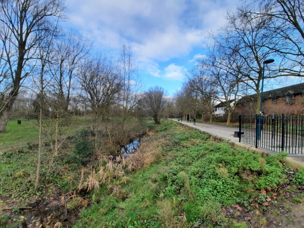
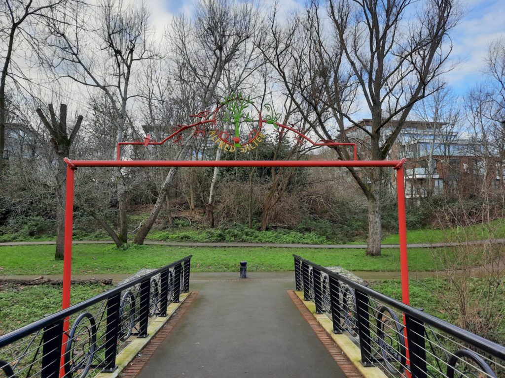
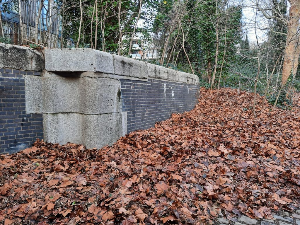
Some more images of Russia Dock Woodland. That little trickle of water on the right marks the path of what was once the canal link between Russia and Greenland docks.I couldn’t quite work out if there was a method to the naming of these footbridges, but did discover that Alfred Salter was a doctor and Labour Party politician. [Edit: I’ve been reliably informed they are named after local primary schools, with designs by the pupils. Thanks James!]Former dock infrastructure now measuring the depth of winter leaves instead of water.
Historic Rotherhithe Walk: Greenland Dock
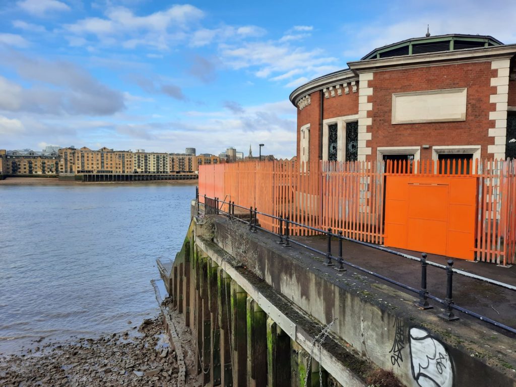
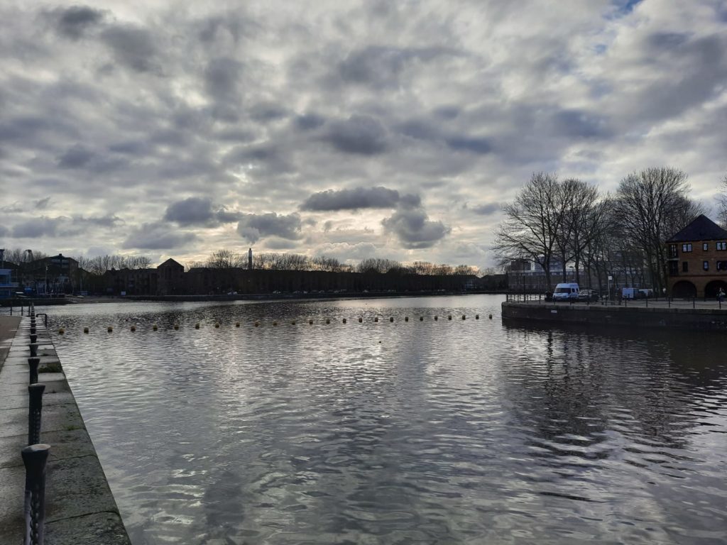
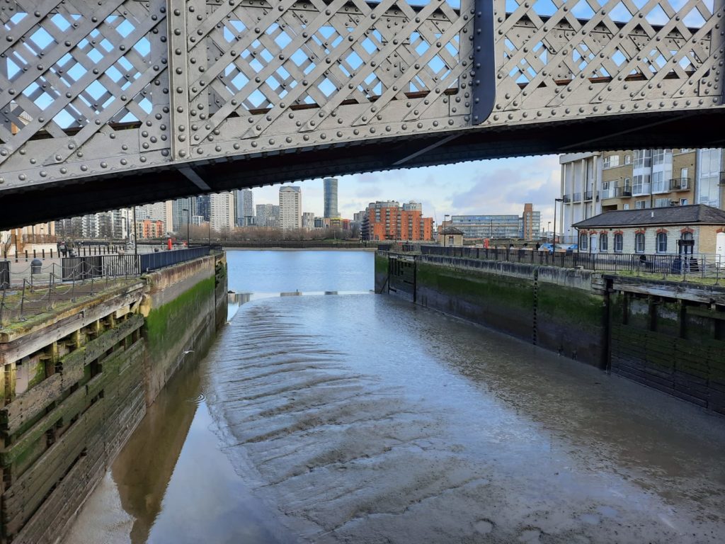
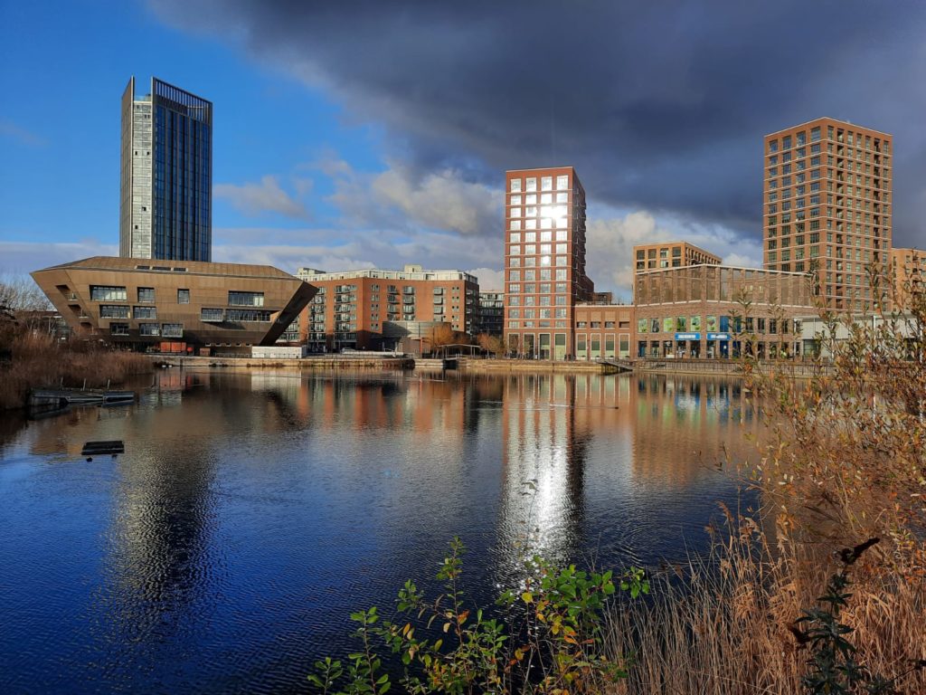
Greenland Dock was one of London’s earliest enclosed commercial docks. Built between 1696 and 1699, it could hold 120 ships. Its name derives from the fact that it was the main London berth for Arctic whalers.From the 19th Century Greenland Dock primarily handled timber. In fact, Surrey Docks was the largest timber importer in the world at the time. This came to an end around 1970, as Greenland and other similar docks were not deep enough to handle modern commercial shipping.A little pseudo-historic feature at Greenland Dock: a former swing bridge is now stationary, but retains the look of a swing bridge. Docklands regeneration has a lot of these simulated echoes of the past.Where Greenland Dock meets the Thames. We are now looking more or less East, whereas the last time we saw the Thames at Rotherhithe we were looking West. Peninsulas, huh?
These peaceful scenes today at Greenland Dock give no indication of the devastation of WWII. In a single night in 1940, 350,000 tons of timber burned after Docklands bombing. The disruption didn’t stop these docks producing huge concrete blocks for a floating harbour to support the D-Day landings.
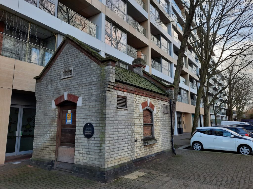
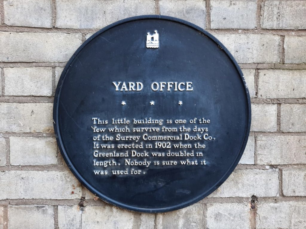
I love historic holdouts like this. Do we know what this building is for? No, we don’t. But has it survived longer than most of its more obvious peers? Yes, it has. Long live this little useless bricked up something-or-other.
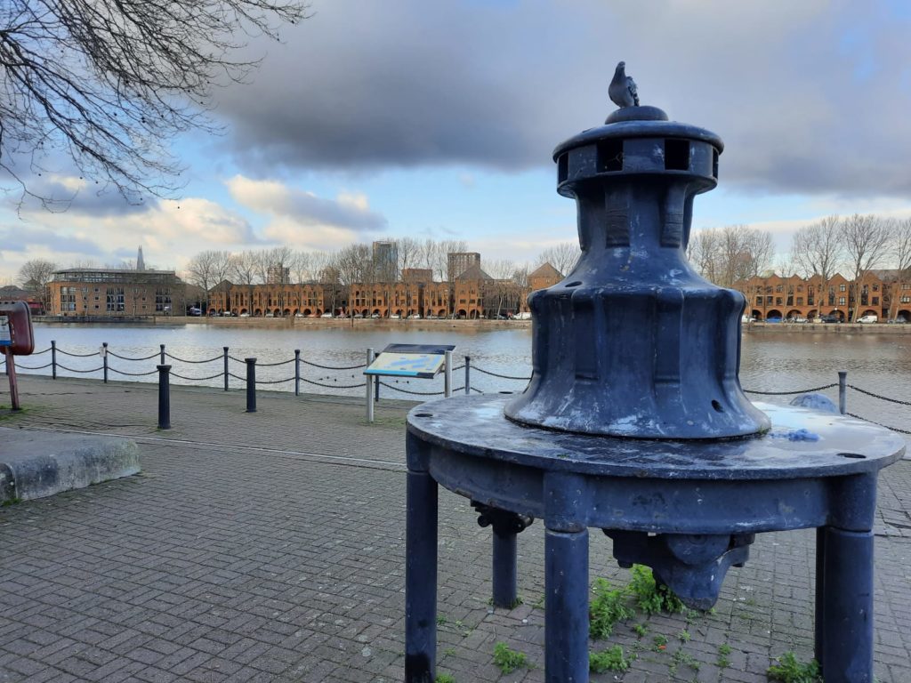
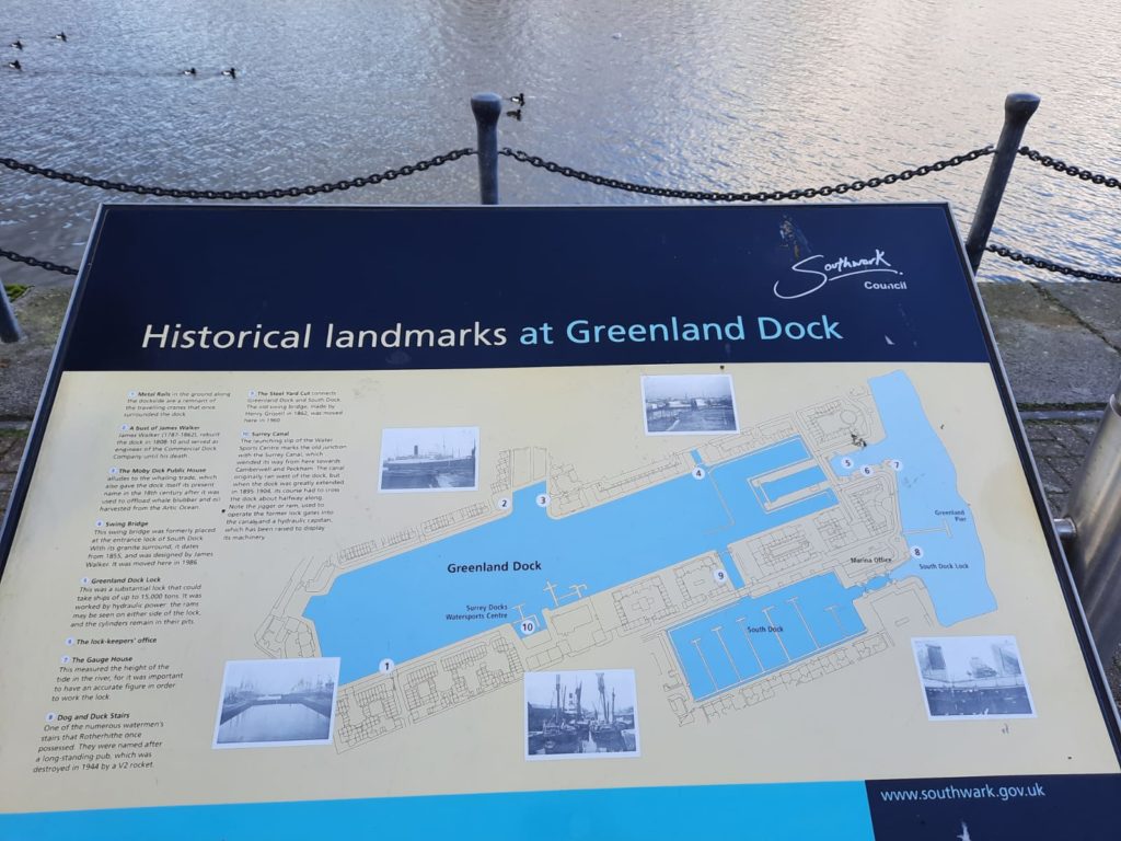
I liked this information panel, which explains some of the dock machinery which is still dotted around. ‘Dockland memorabilia’, my guidebook calls it. Having said that, I can’t tell you what this thing on the left is!Goodbye to Greenland Dock, it’s been great!
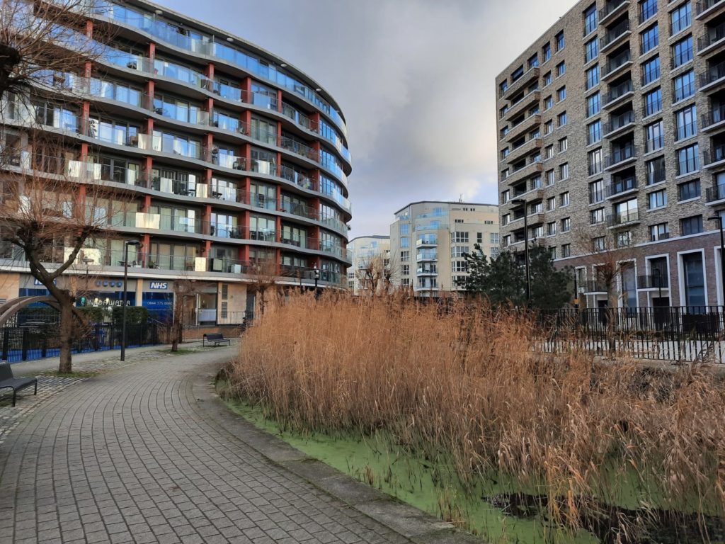
Historic Rotherhithe Walk: Canada Water, Albion Channel and Surrey Water
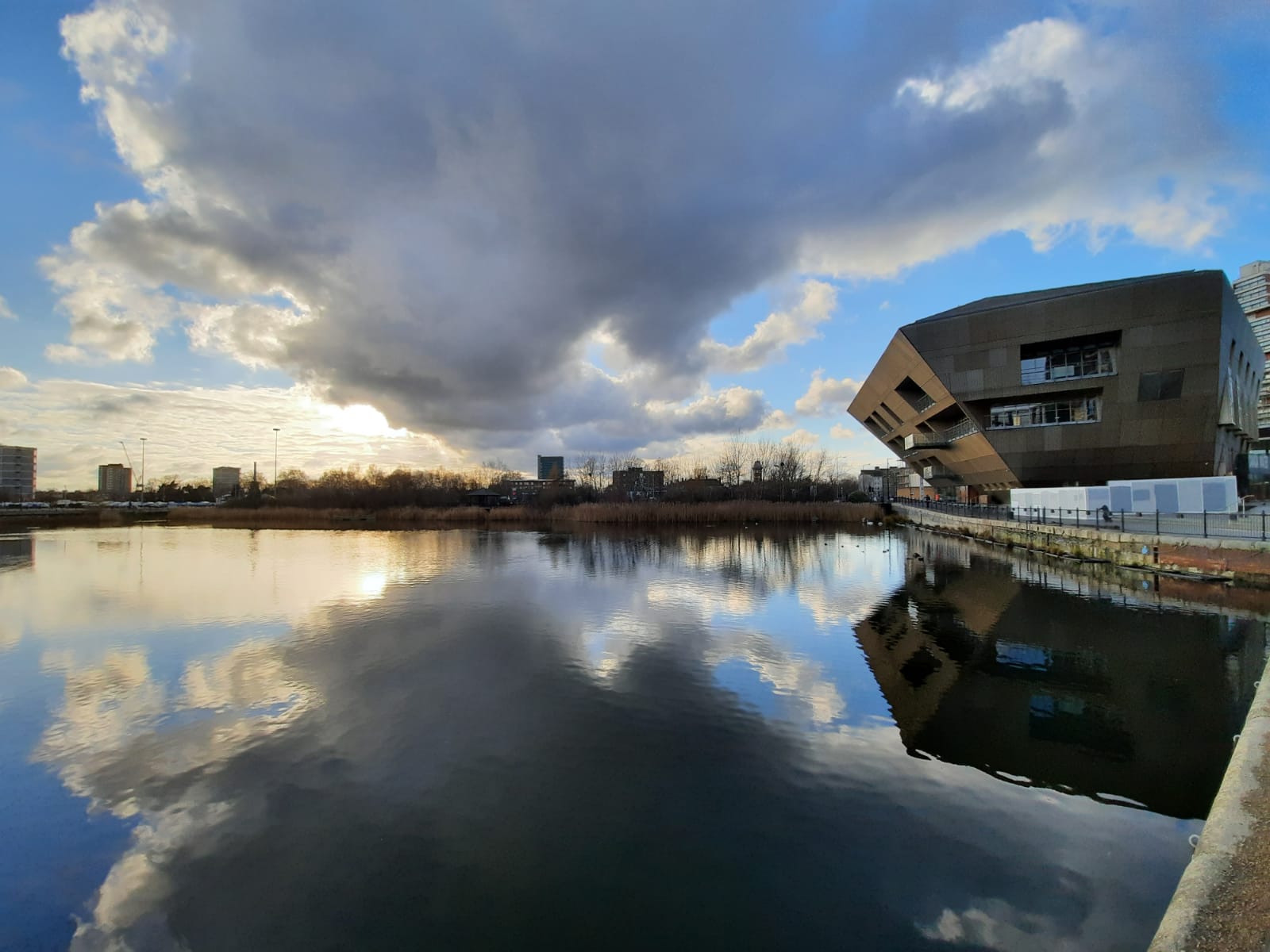
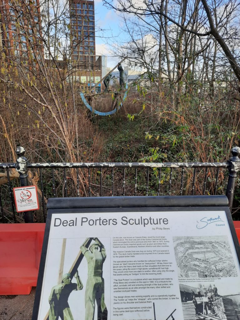
Canada Water has been nicely done up. My guidebook informs me that in the 1930s, more than 2 million tons of tinned food, bacon, dairy etc. came from North America each year.The clocktower of a Victorian dockmaster’s house can just be seen beyond the car park. Canada Water these days is all about the mall.This sculpture by Philip Bews is a little hard to spot amongst all the reeds. It shows two deal porters, a specialised group of London dock workers who handled and stacked timber. ‘Deal’ in this context refers to softwood timbers. A short video here on YouTube explains more.
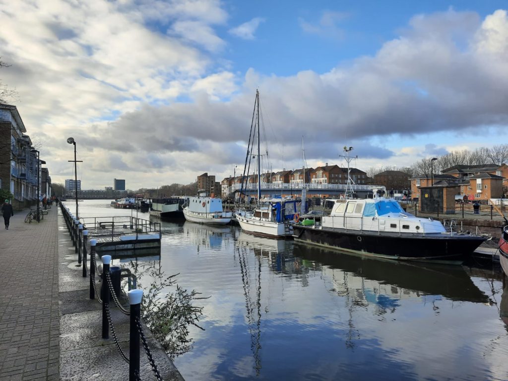
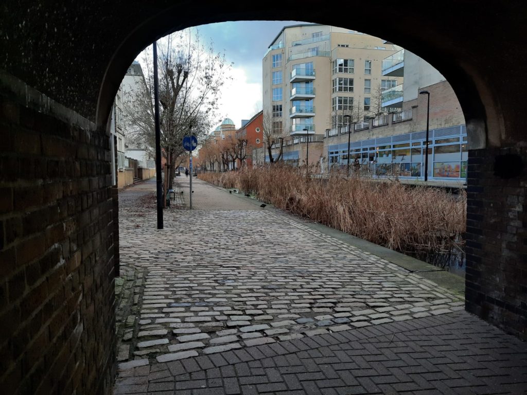
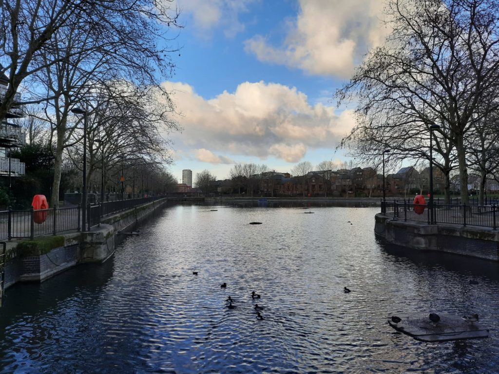
This nice (if reed-choked) waterway from Canada Water to Surrey Water/Rotherhithe is Albion Channel. It started life as Albion Dock but was mostly filled in in the 1980s and now wends its way between blocks of flats.We finish our walk at Surrey Water, at the end of which is Rotherhithe Street where we began. Another former industrial space which has become a public leisure area, with enough wildlife to keep it interesting even on a winter stroll.
Thank you for joining me on this wintery walk! For more local history, sign up below for the weekly Salterton Arts Review newsletter:
Travelers' Map is loading... If you see this after your page is loaded completely, leafletJS files are missing.
9 thoughts on “The Rotherhithe Peninsula – A Historic Walk”
9 thoughts on “The Rotherhithe Peninsula – A Historic Walk”