Long-time London resident and avid museum and theatre-goer. I started this blog in 2014, and got serious about it in 2020 when I realised how much I missed arts and culture during lockdowns. I go to a lot more events than anyone would think is sensible, and love sharing my thoughts in the forms of reviews, the occasional thought piece, and travel recommendations when I leave my London HQ.
A walk through Spitalfields, exploring the ever-changing nature of this London neighbourhood. Along the way we will see traces of its Jewish, Bangladeshi, Huguenot and weaving populations.
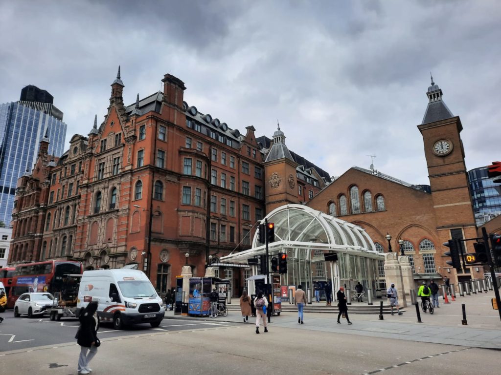
Today’s walk is another provided by Tower Hamlets Council on the Idea Store website. You can find a PDF version here if you want to try the walk yourself. The walk takes about an hour, starting and finishing at Liverpool Street Station.
Another Walk Courtesy of Tower Hamlets Council
Like our recent Black History Walk in Tower Hamlets, the inspiration for today’s post came from this page of local history walk resources from Tower Hamlets’ Idea Store (fancy name for local library). Many months into lockdown, it’s a good way to find inspiration in my own borough. Many of their walks are also community-focused, so offer an interesting lens through which to view the borough.
Today’s walk takes in a neighbourhood which has been defined by different communities at different points in time. Spitalfields has by turns been synonymous with weavers (including Huguenots), Jewish, and later Bangladeshi communities. Each of these layers of history has left its traces, which we will explore shortly. If I have one criticism of the walking guide, it’s that it identifies a lot of interesting spots, but doesn’t go into much depth on the history of the area. So let me do that now before we continue.
Spitalfields: A Potted History
The ‘spital’ in Spitalfields comes from ‘hospital’; over time, ‘The New Hospital of St Mary Without Bishopsgate’ became ‘St Mary Spital’. St Mary Spital was a priory founded in 1197 on the site of a Roman cemetery. It was one of the biggest hospitals in medieval England. Like so many others, Henry VIII dissolved it in the Reformation – the chapel and monastic buildings did not survive. Some of the land became an artillery ground, under the jurisdiction of the Tower of London.
After the Great Fire of London, Spitalfields became one of the first planned suburbs in the city. Charles II asked Sir Christopher Wren to value his property holdings in the area, and granted a charter for a market. Many of the small streets still conform today to the 17th Century plan. Master weavers lived in nice terraced houses, and other workers in the weaving industry in more modest dwellings. Irish and Huguenot communities made up most of the weaving industry at this time. When the silk industry declined in the 19th Century, a new Jewish population took their place and established tailoring and similar businesses. The continuity of the area’s textile industry continued in the late 20th Century as Bangladeshi migrants replaced the Jewish community in turn.
With this potted history under our belts, let us investigate how these layers of history manifest themselves today!
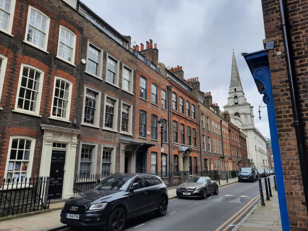
Historic Spitalfields – Liverpool Street to Sandy’s Row
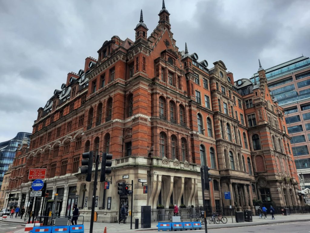
We come to our first sight just as we reach Liverpool Street Station. The imposing red brick building is the Great Eastern Hotel, dating to 1884. The hotel mentions that at one time Terence Conran owned and renovated the hotel, but I discovered several more interesting facts on its Wikipedia page. At one time guests could benefit from a daily delivery of fresh sea water for bathing. And the hotel has not one but two Masonic temples inside – an Egyptian one and a Grecian one. How odd! For many years this was the only hotel within the City of London.
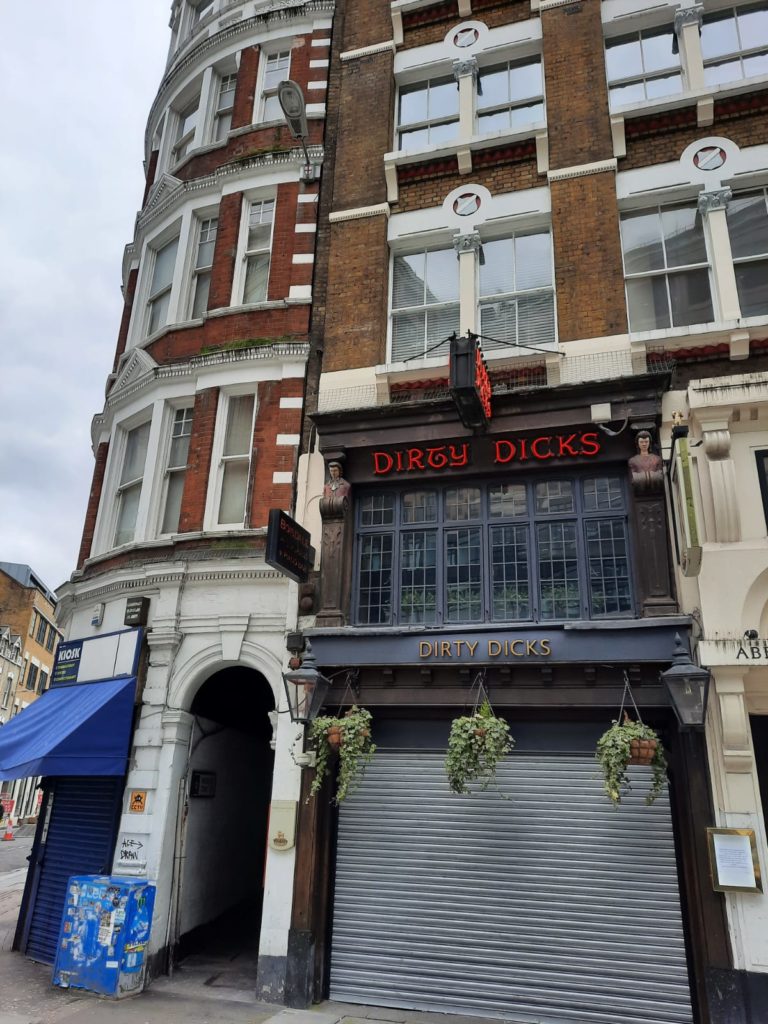
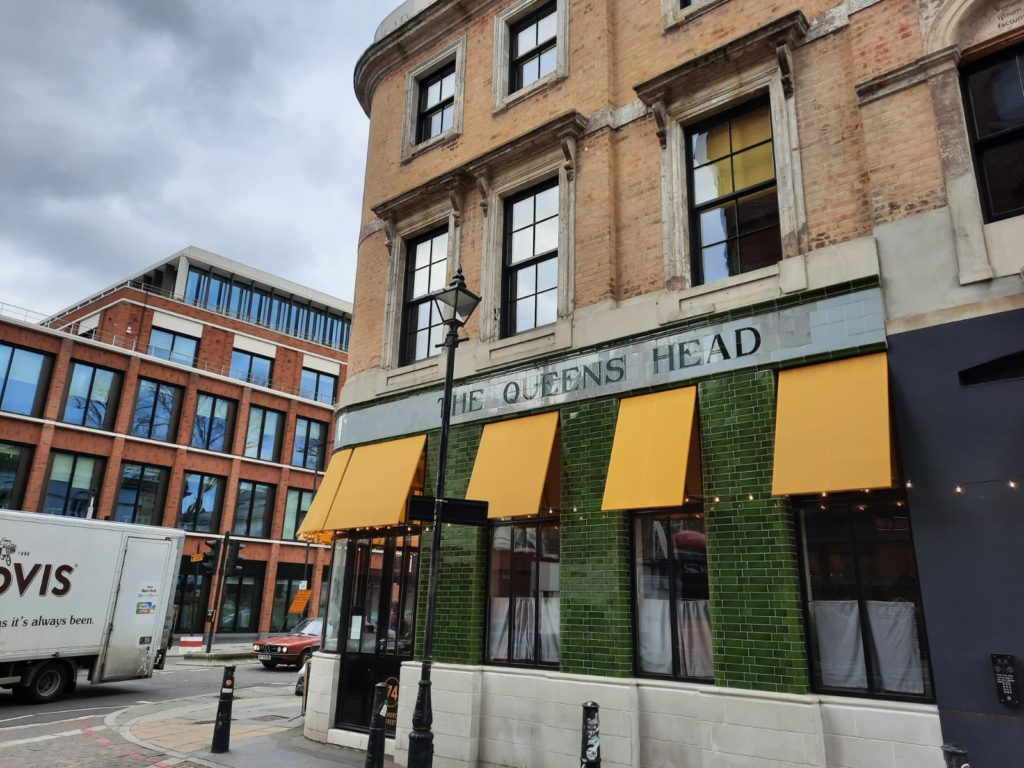
I’m hoping to write future a post about a few of London’s historic pubs. You know, once pubs are open again. In the meantime here is Dirty Dick’s. It might sound like some sort of tacky pub for hen nights, but is actually very historic. The original Dick was really named Nathaniel Bentley. Bentley had a Miss Havisham moment and stopped washing after his fiancée died on their wedding day; this pub, which he owned, cashed in on his notoriety after his death. Various detritus including cobwebs and dead cats once decorated a cellar bar but are now apparently relegated to a display case.
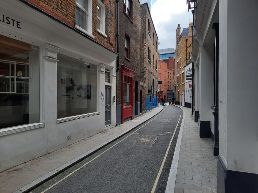
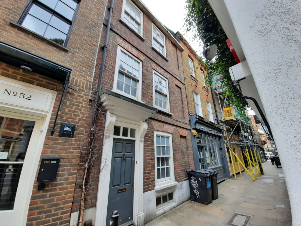
We now head down Artillery Lane, where these boundary markers indicate that we are leaving the City of London for Tower Hamlets. The name of Artillery Lane recalls the post-Reformation artillery ground I mentioned above.
These are some of the narrow streets which still follow the post-Great Fire layout.
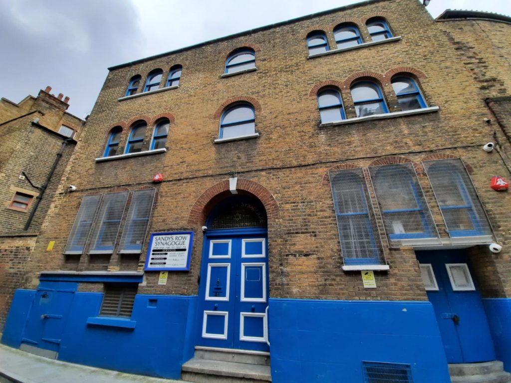
Sandy’s Row Synagogue was once a French Huguenot church, ‘L’Eglise de l’Artillerie’. The building dates to 1766; as well as Huguenots it has been a place of worship for Unitarian and Scottish Baptists amongst other groups. In the 1840s, a Dutch Ashkenazi Jewish community began forming in this area. Their customs were distinct enough that they wanted their own synagogue, and leased this building in 1867. In recent years the congregation has declined, but is apparently growing once more.
Historic Spitalfields – Artillery Passage to Tenter Ground
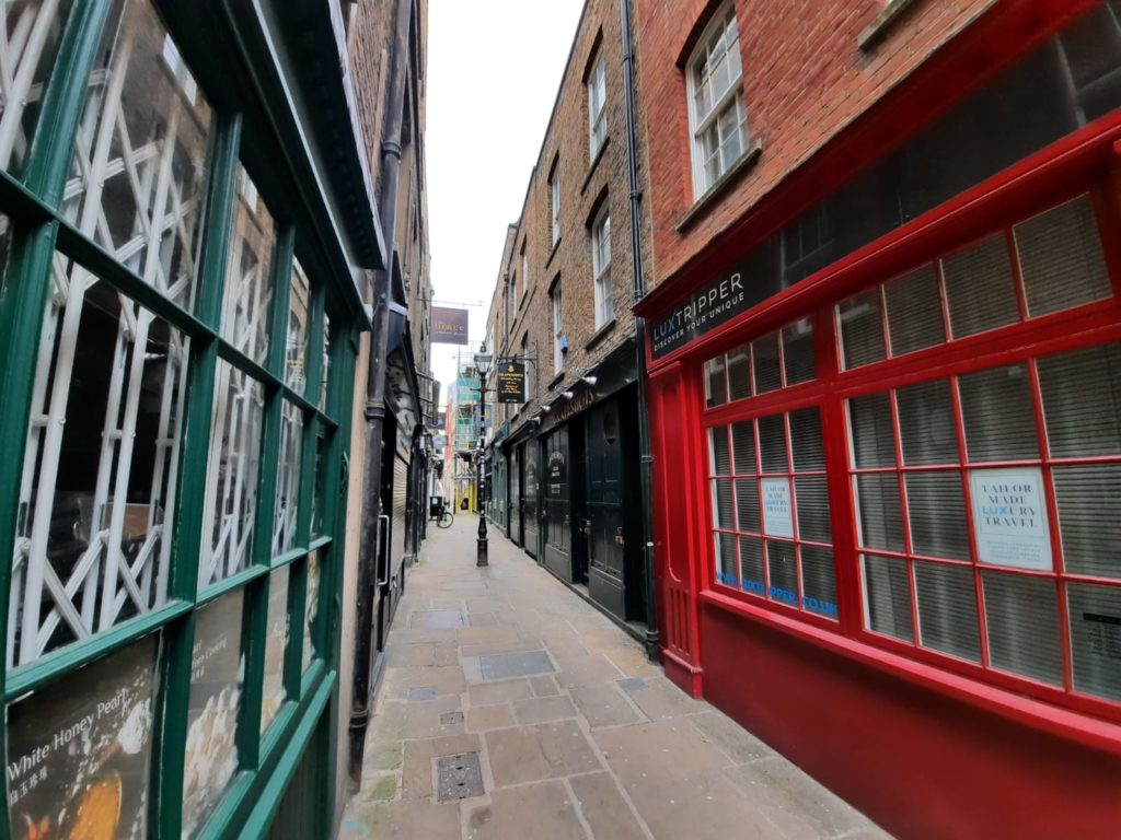
Artillery Row is a particularly narrow street even for this area. Our guide tells us that it was made just wide enough for a horse and cart to pass.
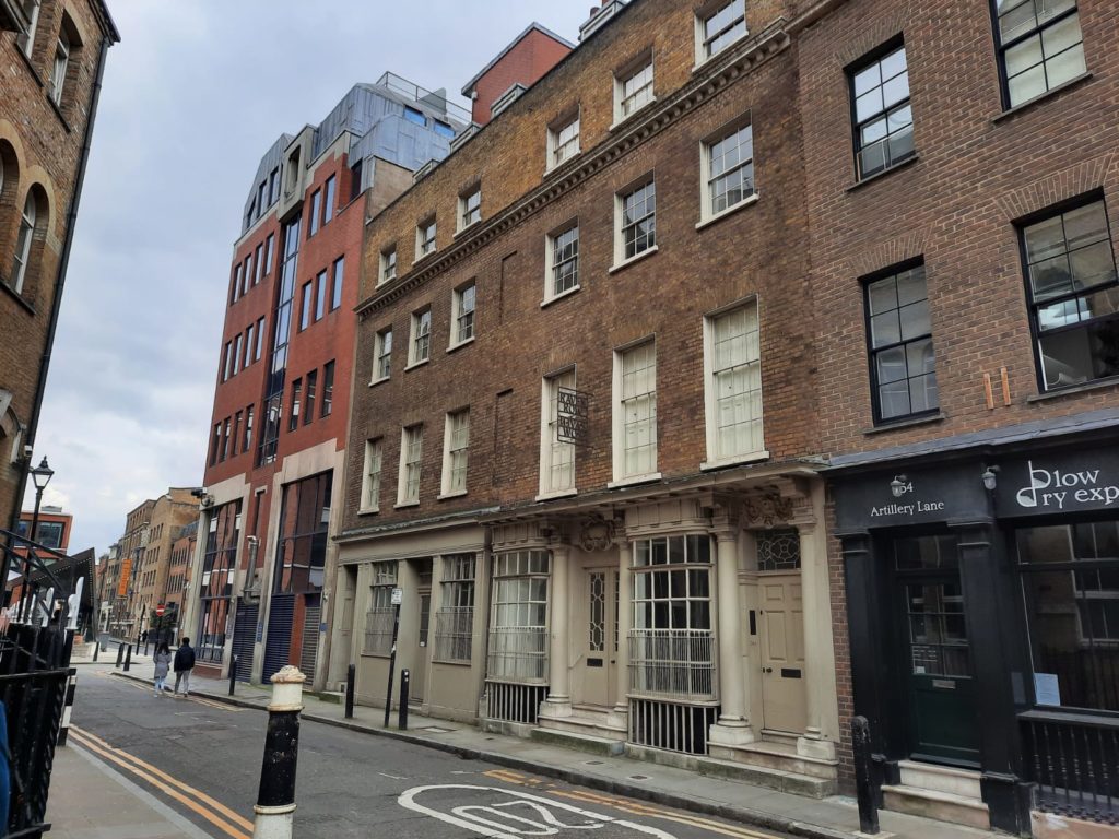
Our walking guide points out these two houses on Artillery Passage as indicative of the growing wealth of the area in the 18th Century. Number 9A at the top is typical of houses dating to shortly after the Great Fire. Numbers 56-58 at the bottom were built by successful (and wealthy) silk merchants – the building is Grade I listed for its historic importance.
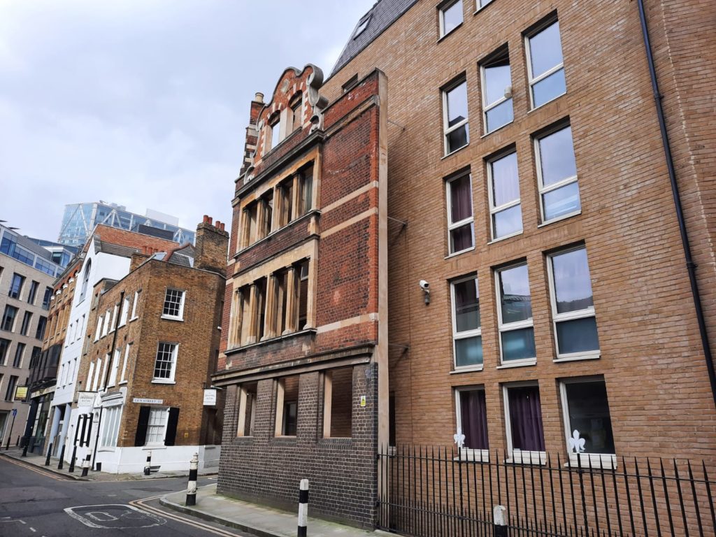
Not to name and shame, but this caught my eye as a really bad example of “heritage preservation.” Not only does the facade look a bit stranded – it also manages to block the light to all the windows behind. I don’t really understand what they were hoping to achieve…
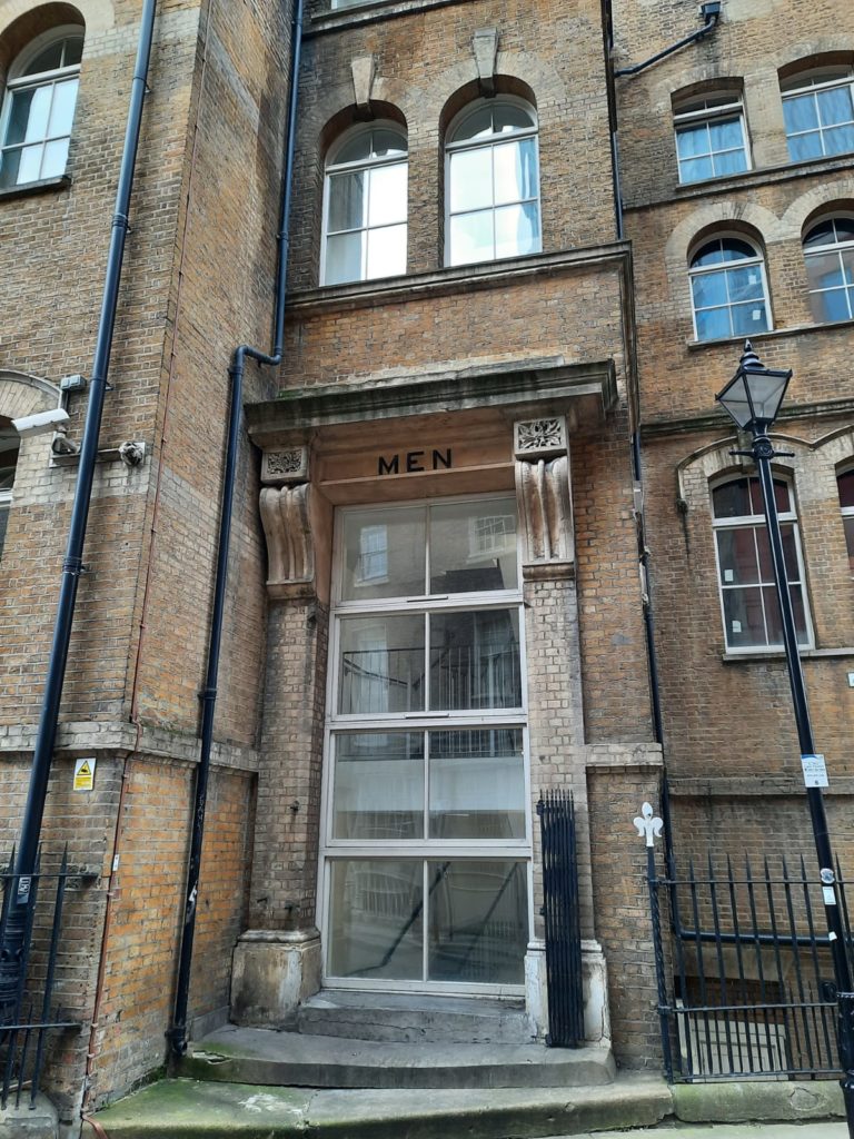
The inscription above this door is a reminder of when the building was a night shelter. In the 19th Century the Sisters of Mercy had beds for 100 women and 20 men of ‘good character’.
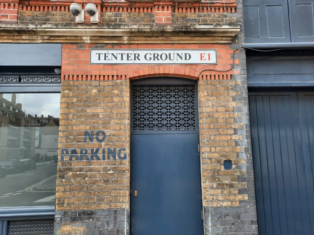
Tenter Ground, like Hatfields which we saw on our walk along the Neckinger, is a street name which reminds us of a lost craft. Hatfields was where hat-makers dried their animal skins. Tenter frames were devices for stretching woven cloth. They are the origin of the phrase ‘on tenter hooks’. By using them weavers could double the length of their cloth and thus increase their profits.
Historic Spitalfields – Soup Kitchens, Markets and Street Art
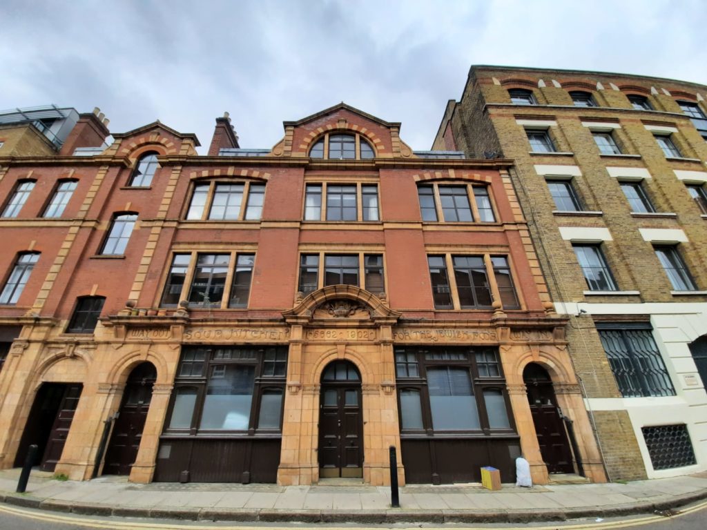
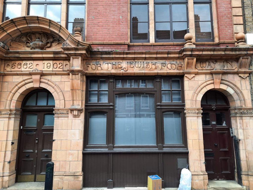
On Brune Street just around the corner is this former soup kitchen. Serving the Jewish community specifically, the inscription above the door has both the Gregorian and Hebrew dates.
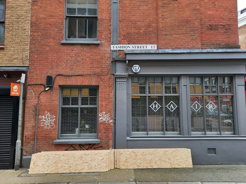
The textile connection to this area manifests itself in another street name: Fashion Street. Nearby, a former pub is now a trendy coffee spot – original tilework intact.
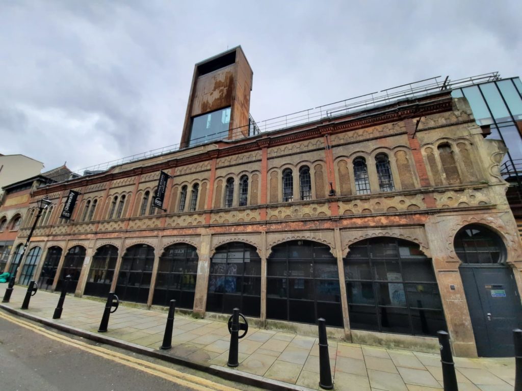
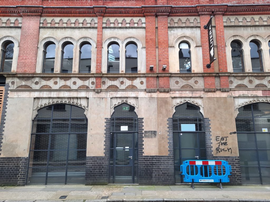
Abraham Davis built this striking Moorish Market in 1905. He hoped to tempt market traders to sell their wares within it, but they weren’t buying it (ha!). The market closed in 1909, and looks to have housed a number of different businesses and services over the years. It is a lengthy building, running most of the way down Fashion Street.
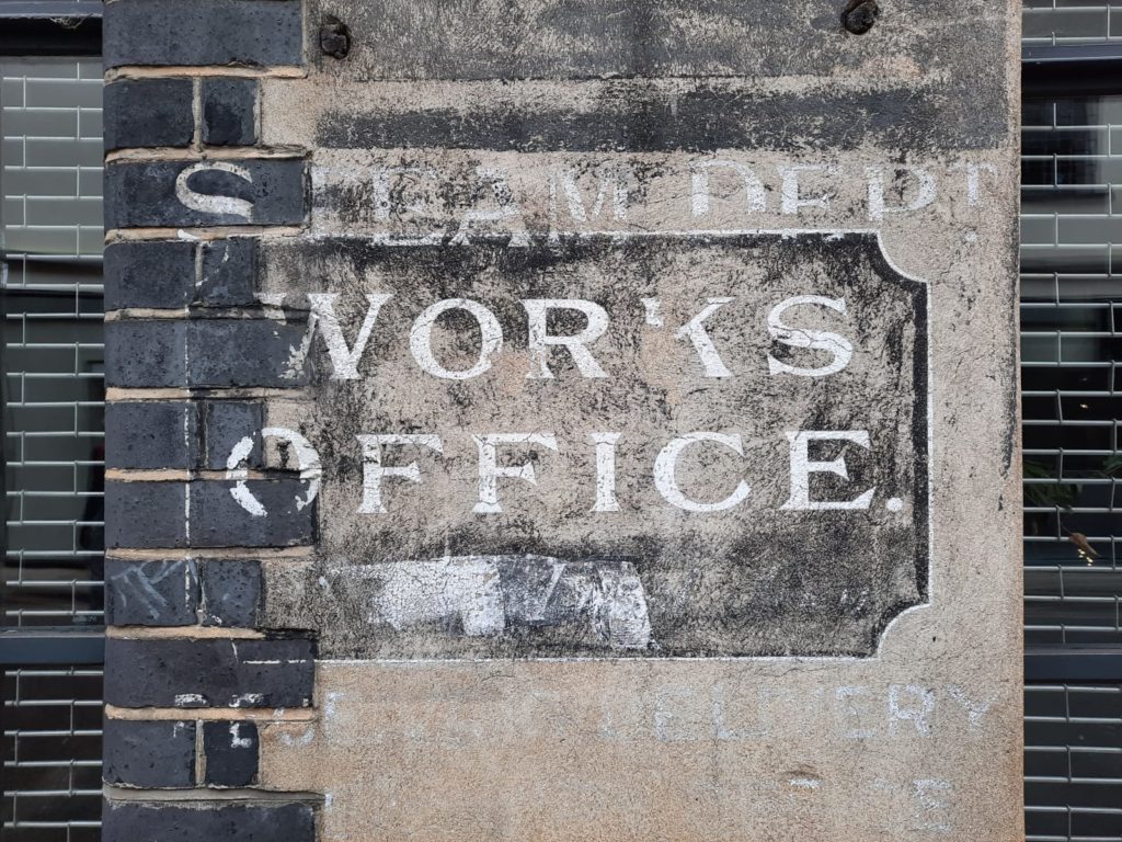
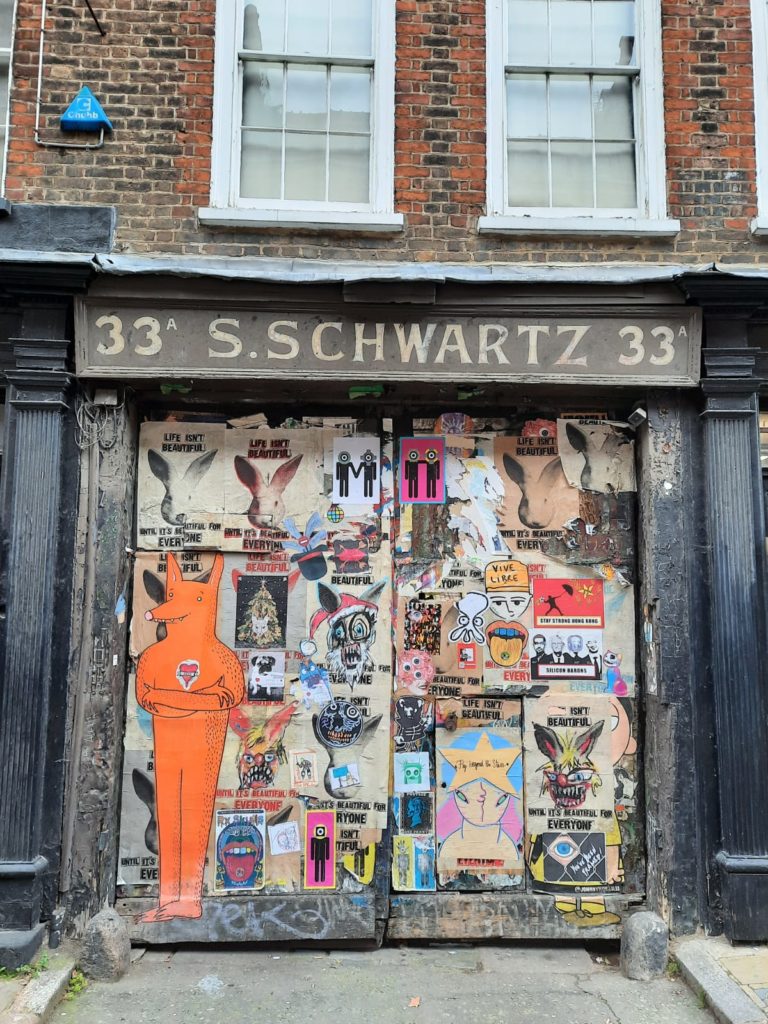
In and around the Moorish Market we see the marks of different generations on the built environment. This site has a good blog post on ‘dead’ signs around Spitalfields including the one I have snapped here of the Steam Department Works Office. No comment on that clown at the bottom.
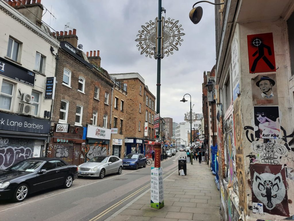
Historic Spitalfields – Brick Lane
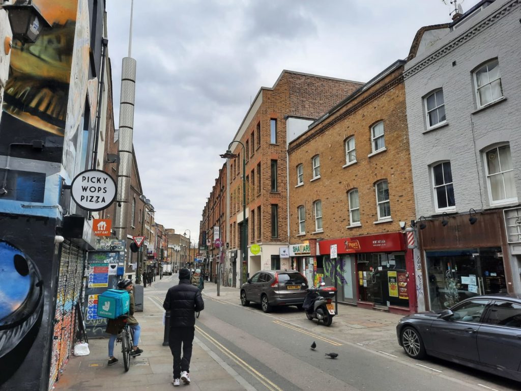
Here is a very quiet Brick Lane, lockdown edition. Brick Lane takes its name from the many bricks transported through here to rebuild London after the Great Fire. This is the part of Spitalfields where the moniker ‘Banglatown’ feels most appropriate. The street is normally full of bustling Bengali and Indian restaurants, with touts on the street competing for business. It is currently a little quiet and sad by comparison!
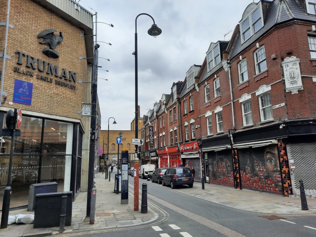
Truman’s Brewery was in operation from 1666 to 1989, before being reestablished in 2010 (in Hackney). The area was popular with brewers as there is an artesian well under these streets. From 1989 the brewery buildings have played host to small business, nightclubs and so on.
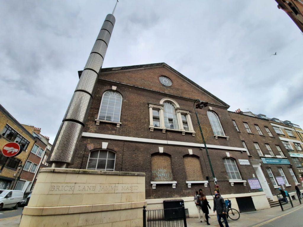
At first glance, the Brick Lane Jamme Majid is a mosque. At second glance, the building is clearly a lot older. In true London fashion, however, it has retained the same usage through changes in population. Like the Sandy’s Row Synagogue, it started as a Huguenot chapel, ‘La Neuve Eglise’, in 1743. In 1809 it became a Wesleyan chapel to minister to the local Jewish population, before becoming Methodist in 1819. Its next incarnation was as the Machzike Hadath, or Spitalfields Great Synagogue. In 1976 the local Bangladeshi population bought and refurbished the building as a mosque.
Historic Spitalfields – Spotlight on Fournier Street
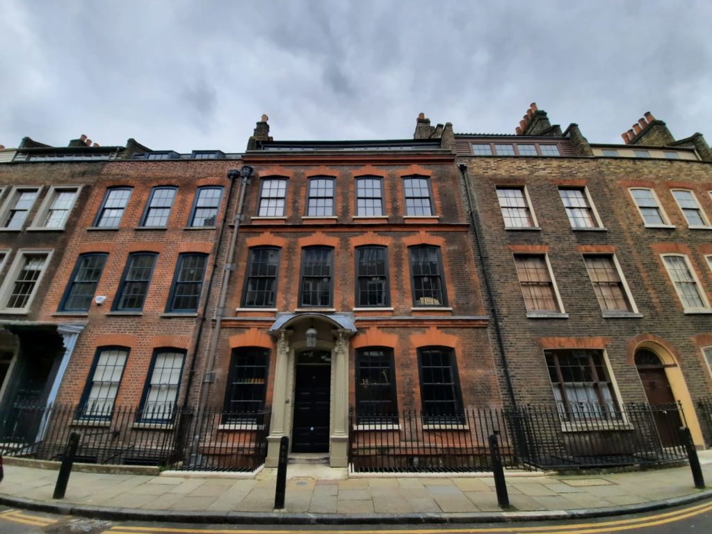
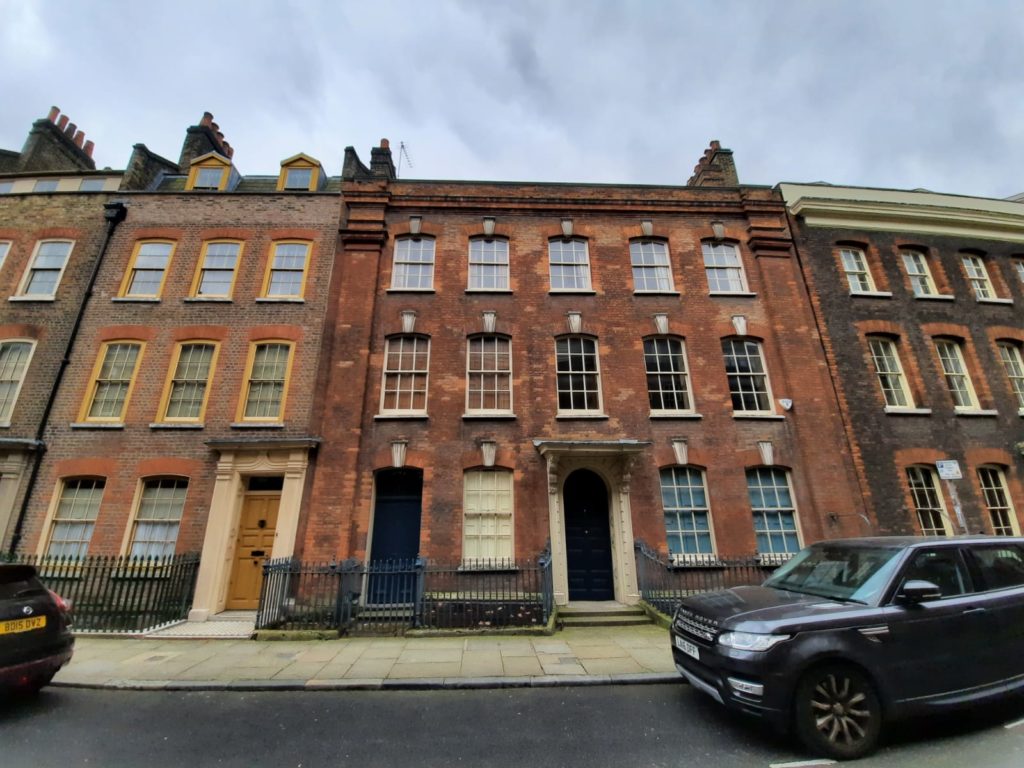
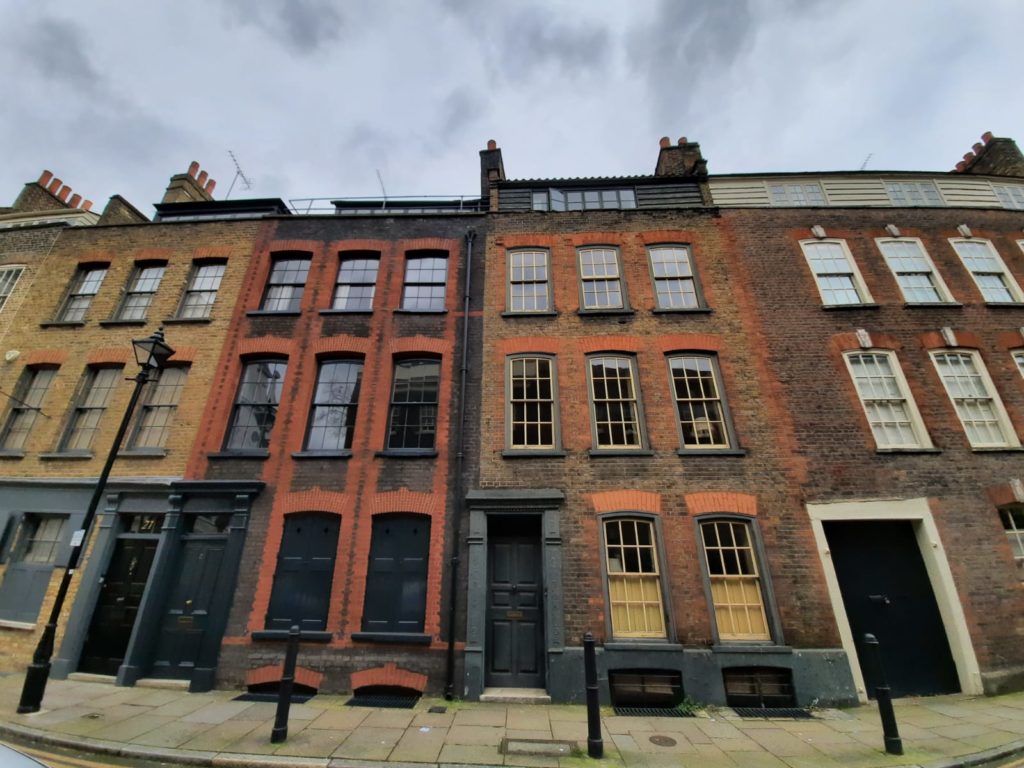
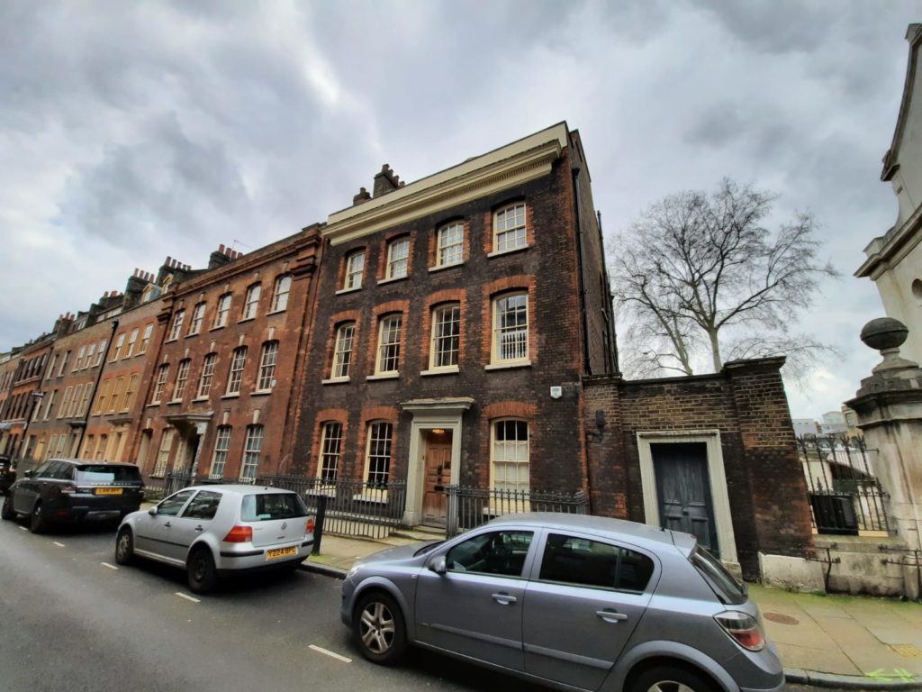
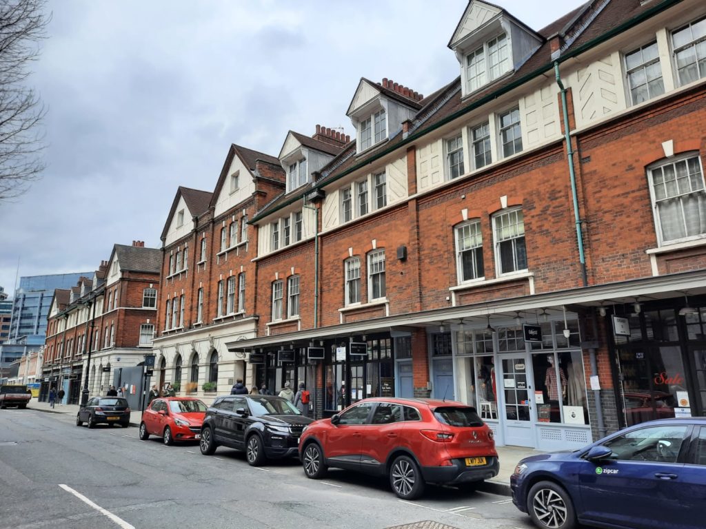
Fournier Street, just off Brick Lane, is one of the best remaining examples of a complete early-18th Century street in London. I love how the buildings are all charming variations on a theme.
Fournier Street also provides us with one of many traces in Spitalfields of Jewish businesses from days gone by.
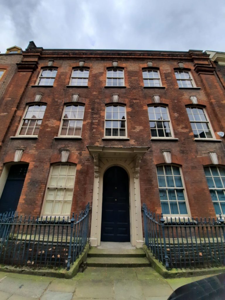
No. 2 Fournier Street is the Christ Church Rectory. Nicholas Hawksmoor built it in the same style as Christ Church next door. It has always remained the rectory and must be a splendid place to live.
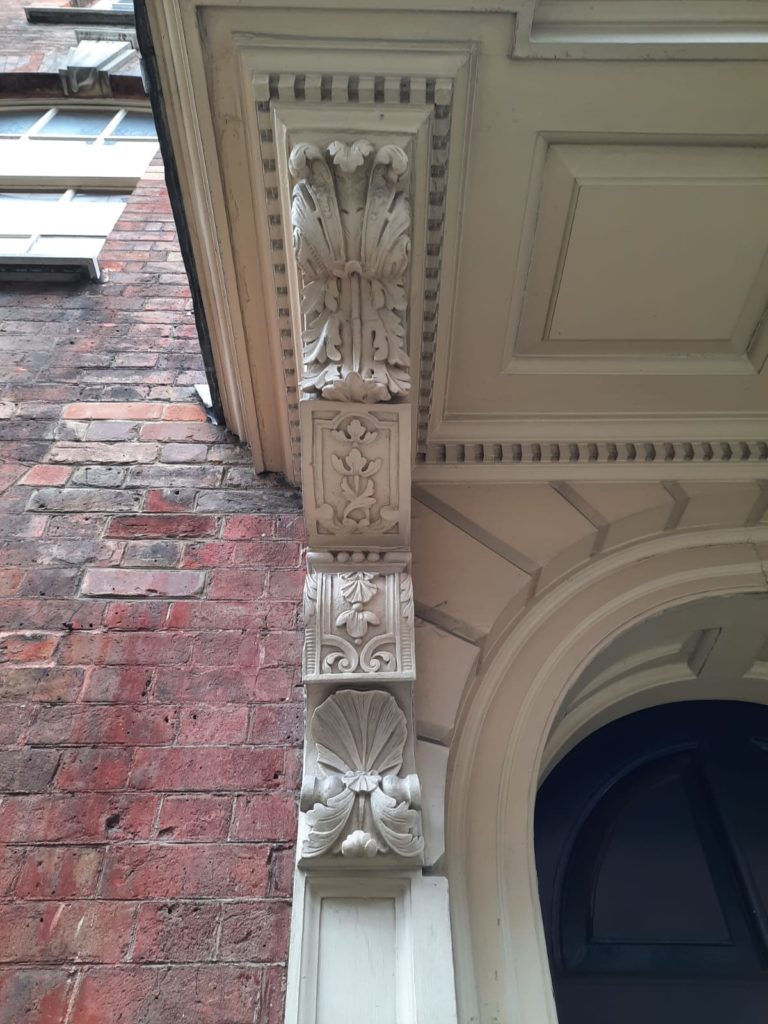
Marmaduke Smith build No. 4 Fournier Street in 1726. He was a local carpenter and built this as his own residence. Our walking guide describes the scallop shells in the bottom image as being like a welcome mat; they were the pilgrim badge of St James so signalled a friendly welcome to travellers.
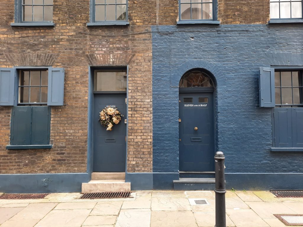
And lastly on Fournier Street, where else apart from historic London could you find yourself living in No. Eleven and a Half?
Historic Spitalfields – Christ Church to Spitalfields Market
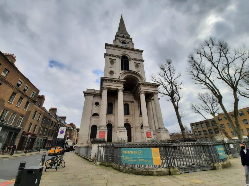
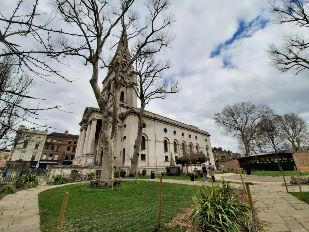
As you may have realised from the fact that he built the rectory, Christ Church is a Hawksmoor design. Hawksmoor was a student of Sir Christopher Wren – we have seen his churches before on this walk and this one. Christ Church stood empty for 30 years from 1957 until an extensive restoration campaign began. When first built, Christ Church was apparently a show of Anglican authority. The French Huguenots then dominant in the area were religious dissenters and so had their own chapels, a couple of which we have seen above. Christ Church firmly stamped the Church of England on the Spitalfields map.
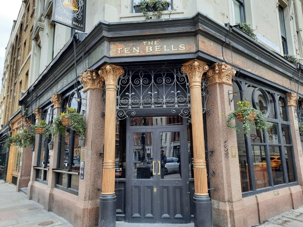
I don’t think I’ve ever actually been to The Ten Bells, because it’s normally a very busy pub. It’s also very historic. Its name comes from a competition between Christ Church and St Bride’s, Fleet Street, over who had the best peal of bells. Each church kept adding more, and the pub changed its name when Christ Church reached ten bells. It now apparently has twelve. The pub has historically also traded on apparent connections with the Jack the Ripper murders.
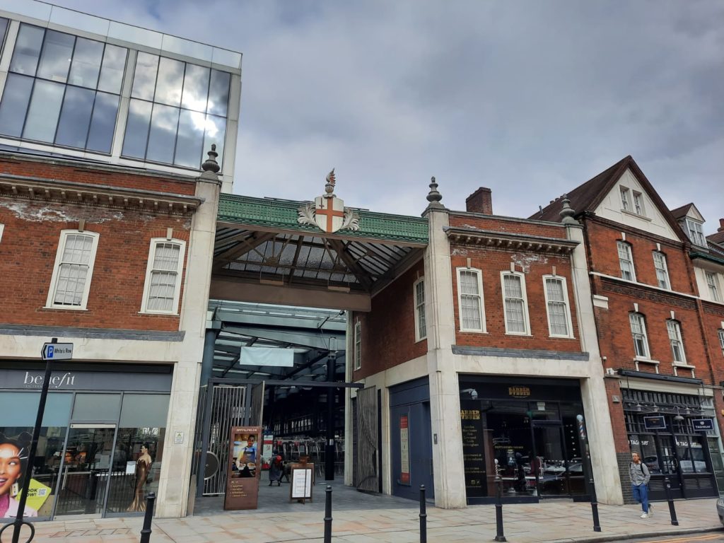
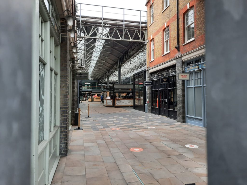
From the outside, Spitalfields Market does a good impression of a row of houses. Inside it is normally bustling with traders and customers at the stalls and permanent businesses. The original livestock and produce market moved to the Lea Valley in the 1990s. Today Spitalfields focuses on food and crafts. At the time of writing (in March) it was eerily quiet; open as a thoroughfare but not for business.
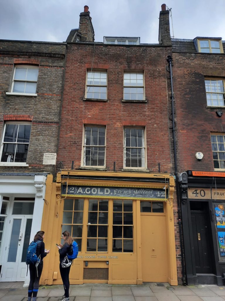
This historic building is a rare survival of a downstairs shop and upstairs accommodation remaining intact. It also marks the boundary of where the artillery ground once was. It’s opposite Spitalfields Market, and happens to be on the market right now for a cool £2,300,000 if you’ve got that kind of cash.
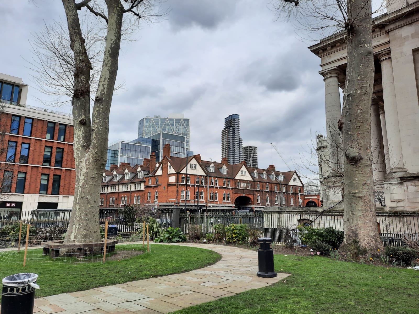
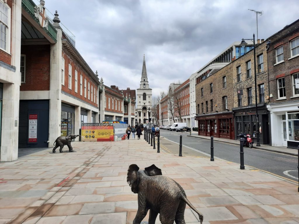
We now bid adieu, להתראות and বিদায় to Spitalfields. In the background Christ Church imposes itself on the neighbourhood, while in the foreground there is a pop up herd of elephants. The statues are part of the Herd of Hope, an awareness raising campaign by a wildlife charity. Even after so many walks around the City of London and East London neighbourhoods, this walk around Spitalfields felt distinctive. I enjoyed the very visible and tangible layers of history one on top of another, and the continuity of purpose of this area and its buildings over so many centuries. I hope you enjoyed it too!
Want to explore more London neighbourhoods? Sign up below for the Salterton Arts Review newsletter:
Travelers' Map is loading... If you see this after your page is loaded completely, leafletJS files are missing.


4 thoughts on “Layers of History in Spitalfields”